Category:Maps of Burundi
Jump to navigation
Jump to search
Countries of Africa: Algeria · Angola · Benin · Botswana · Burkina Faso · Burundi · Cameroon · Cape Verde · Central African Republic · Chad · Comoros · Democratic Republic of the Congo · Republic of the Congo · Djibouti · Egypt‡ · Equatorial Guinea · Eritrea · Eswatini · Ethiopia · Gabon · The Gambia · Ghana · Guinea · Guinea-Bissau · Ivory Coast · Kenya · Lesotho · Liberia · Libya · Madagascar · Malawi · Mali · Mauritania · Mauritius · Morocco · Mozambique · Namibia · Niger · Nigeria · Rwanda · São Tomé and Príncipe · Senegal · Seychelles · Sierra Leone · Somalia · South Africa · South Sudan · Sudan · Tanzania · Togo · Tunisia · Uganda · Zambia · Zimbabwe
Limited recognition: Ambazonia · Azawad · Puntland · Sahrawi Arab Democratic Republic · Somaliland – Other areas: Canary Islands · Ceuta · Madeira · Mayotte · Melilla · Réunion · Saint Helena, Ascension and Tristan da Cunha · Scattered Islands in the Indian Ocean · Western Sahara
‡: partly located in Africa
Wikimedia category | |||||
| Upload media | |||||
| Instance of | |||||
|---|---|---|---|---|---|
| Category combines topics | |||||
 | |||||
Maps of Burundi.
Subcategories
This category has the following 21 subcategories, out of 21 total.
B
- Maps of borders of Burundi (3 F)
- Maps of Bujumbura (15 F)
C
E
- ECHO Daily Maps of Burundi (6 F)
- Election maps of Burundi (2 F)
F
H
L
- Location maps of Burundi (5 F)
M
- Maps of Burundi on stamps (1 F)
O
P
R
- Maps of rivers of Burundi (3 F)
S
T
Pages in category "Maps of Burundi"
The following 2 pages are in this category, out of 2 total.
Media in category "Maps of Burundi"
The following 37 files are in this category, out of 37 total.
-
 Administrative division of the Itaba Municipality.png 841 × 1,088; 41 KB
-
 AT0704 map.png 1,002 × 803; 46 KB
-
 AT0721 map.png 868 × 811; 29 KB
-
 Bujumbura 29.36607E 3.37443S.jpg 1,280 × 958; 169 KB
-
 Burundi (orthographic projection).svg 550 × 550; 183 KB
-
 Burundi 29.94735E 3.34327S.jpg 1,280 × 958; 136 KB
-
 Burundi collines.png 859 × 1,027; 114 KB
-
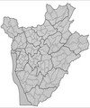
 Burundi communes.png 865 × 1,027; 22 KB
-
 Burundi Hydrogeology2.png 687 × 1,000; 20 KB
-
 Burundi map OMC.png 923 × 905; 33 KB
-
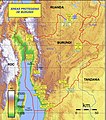 Burundi Protected areas.jpg 1,401 × 1,582; 958 KB
-
 Burundi Provinces Arabic.png 590 × 600; 72 KB
-
 Burundi Rwanda Locator.png 456 × 244; 7 KB
-
 Burundi Rwanda relations map (cropped).png 3,280 × 1,896; 141 KB
-
 Burundi Rwanda relations map.png 5,993 × 3,406; 341 KB
-
 Burundi sat.png 223 × 259; 86 KB
-
 Burundi, February 2016 (UN).pdf 1,275 × 1,650; 1,020 KB
-
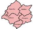 Cankuzo.png 408 × 345; 10 KB
-

-
 ECDM 20140211 CentralAfrica ConflictsFloods.pdf 1,625 × 1,125; 960 KB
-
 ECDM 20150421 World Events.pdf 1,625 × 1,125; 478 KB
-
 ECDM 20150527 World Events.pdf 1,625 × 1,125; 472 KB
-
 ECDM 20150630 World Events.pdf 1,625 × 1,125; 873 KB
-
 ECDM 20150724 2Maps.pdf 1,625 × 1,125, 2 pages; 980 KB
-
 ECDM 20180322 DRC IDPs-Refugees.pdf 1,754 × 1,239; 1,017 KB
-
 ECHO Burundi BaseMap A4 Portrait.png 2,481 × 3,509; 315 KB
-
 FLII Burundi.png 738 × 774; 478 KB
-
 Mapa do Burúndi (OCHA).svg 254 × 254; 386 KB
-
 Martyazo ENG.png 451 × 528; 86 KB
-
 Population density of Burundi provinces.png 2,448 × 3,066; 309 KB
-
 Provinces of Burundi 2014 (named).png 614 × 624; 28 KB
-
 Provinces of Burundi 2014.png 1,025 × 624; 22 KB
-
 Satellite image of Burundi in February 2003.jpg 845 × 980; 122 KB
-
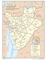
 UN Burundi February 2016.png 1,700 × 2,200; 229 KB
-
 Un-burundi.png 2,348 × 2,766; 1.19 MB
-
 Urundi ramani.jpg 624 × 324; 127 KB
-
 Variantes du français originaires de Belgique utilisées en Afrique.jpg 1,002 × 501; 44 KB


.svg)


.png)


.svg)


.png)


