Category:Midlothian
Zur Navigation springen
Zur Suche springen
Traditional counties (shires) of Scotland: Aberdeenshire · Angus · Argyll ≈ Argyllshire · Ayrshire · Banffshire · Berwickshire · Buteshire · Caithness · Clackmannanshire · Cromartyshire · Dumbartonshire · Dumfriesshire · East Lothian · Fife · Inverness-shire · Kincardineshire · Kinross-shire · Kirkcudbrightshire · Lanarkshire · Midlothian · Moray · Nairnshire · the Orkney Islands ≈ Orkney Islands · Peeblesshire · Perthshire · Renfrewshire · Ross-shire · Roxburghshire · Selkirkshire · the Shetland Islands ≈ Shetland Islands · Stirlingshire · Sutherland · West Lothian · Wigtownshire
Council areas (municipalities) of Scotland: Aberdeen · Aberdeenshire · Angus · Argyll and Bute · Clackmannanshire · Dumfries and Galloway · Dundee · East Ayrshire · East Dunbartonshire · East Lothian · East Renfrewshire · Edinburgh · Falkirk · Fife · Glasgow · Highland · Inverclyde · Midlothian · Moray · North Ayrshire · North Lanarkshire · Outer Hebrides · Orkney Islands · Perth and Kinross · Renfrewshire · Scottish Borders · Shetland Islands · South Ayrshire · South Lanarkshire · Stirling · West Dunbartonshire · West Lothian
Council Area und Grafschaft in Schottland    | |||||
| Medium hochladen | |||||
| Ist ein(e) | |||||
|---|---|---|---|---|---|
| Ort |
| ||||
| Hauptstadt | |||||
| Einwohnerzahl |
| ||||
| Fläche |
| ||||
| Verschieden von | |||||
| offizielle Website | |||||
 | |||||

Unterkategorien
Es werden 25 von insgesamt 25 Unterkategorien in dieser Kategorie angezeigt:
In Klammern die Anzahl der enthaltenen Kategorien (K), Seiten (S), Dateien (D)
A
B
C
E
G
- Gardens in Midlothian (4 D)
H
I
L
M
N
P
- Panoramics of Midlothian (15 D)
S
T
V
W
- Wells in Midlothian (3 D)
Medien in der Kategorie „Midlothian“
Folgende 91 Dateien sind in dieser Kategorie, von 91 insgesamt.
-

-
 A hajdani kaputorony helye (The remains of the olden barbican) - panoramio.jpg 1.600 × 1.200; 891 KB
-
 A Rosslyn-kastély völgyhídján (On the viaduct of the Rosslyn Castle) - panoramio.jpg 1.600 × 1.200; 898 KB
-
 A68 towards Edinburgh - geograph.org.uk - 6164677.jpg 5.184 × 3.888; 5,81 MB
-
 Bellona Foundry Gun Casting - panoramio.jpg 2.048 × 1.536; 807 KB
-
 Biggar Road - panoramio.jpg 2.894 × 2.177; 2,42 MB
-
 Bilston Glen (30516621827).jpg 4.016 × 6.016; 11,18 MB
-
 Blind Poet - panoramio.jpg 2.592 × 1.944; 893 KB
-
 Bonnyrigg Red Rose 0 Brechin City 6.jpg 3.552 × 2.368; 3,69 MB
-
 Box - Flickr - S. Rae.jpg 3.888 × 2.592; 2,89 MB
-
 Coat of arms of Midlothian District Council 1975-1996.svg 497 × 634; 204 KB
-
 Coat of arms of Midlothian District Council.svg 879 × 817; 517 KB
-
 Crichton Glen - habitat shot - Flickr - S. Rae.jpg 3.528 × 2.500; 5,21 MB
-
 Dobbies garden golfer - panoramio.jpg 2.816 × 1.880; 1,53 MB
-
 Dobbies golfer. - panoramio.jpg 1.880 × 2.816; 1,3 MB
-
 Edinburgh College, Midlothian Campus (geograph 5256553).jpg 3.264 × 2.448; 2,11 MB
-
 Edinburgh night (2011.10.21).jpg 4.256 × 2.832; 5,48 MB
-
 Field near Castle Steads - geograph.org.uk - 6079777.jpg 1.024 × 683; 257 KB
-
 Flowers (15623597811).jpg 2.631 × 3.946; 567 KB
-
 Fungi and lichen (10522385364).jpg 3.264 × 4.928; 991 KB
-
-
 Harvesting crops in Scotland (9329).jpg 5.417 × 3.611; 22,17 MB
-
 Harvesting crops in Scotland (9331).jpg 5.442 × 3.628; 24,86 MB
-
 Harvesting crops in Scotland (9332).jpg 5.465 × 3.643; 20,9 MB
-
 High Street gate into Dalkeith Park - geograph.org.uk - 6139533.jpg 640 × 480; 271 KB
-
 James Martin Stagg CB OBE FRSE - geograph.org.uk - 6175399.jpg 3.264 × 2.448; 2,73 MB
-
 Jó nagyot lehetne innen zakózni (It would be a hell of a downfall) - panoramio.jpg 1.600 × 1.200; 949 KB
-
 Midlothian Council Election Structure.png 928 × 464; 36 KB
-
 Midlothian District Council Achievement.png 352 × 521; 110 KB
-
 Midlothian House, Dalkeith.jpg 1.421 × 1.066; 386 KB
-
 Midlothian Map.png 4.967 × 4.967; 6,78 MB
-
 Midlothian, UK - panoramio (1).jpg 1.600 × 1.200; 305 KB
-
 Midlothian, UK - panoramio (10).jpg 1.600 × 1.200; 282 KB
-
 Midlothian, UK - panoramio (11).jpg 1.600 × 1.200; 387 KB
-
 Midlothian, UK - panoramio (12).jpg 1.600 × 1.200; 307 KB
-
 Midlothian, UK - panoramio (13).jpg 1.600 × 1.200; 363 KB
-
 Midlothian, UK - panoramio (14).jpg 1.600 × 354; 328 KB
-
 Midlothian, UK - panoramio (15).jpg 1.200 × 1.600; 935 KB
-
 Midlothian, UK - panoramio (16).jpg 1.200 × 1.600; 922 KB
-
 Midlothian, UK - panoramio (2).jpg 1.600 × 1.200; 340 KB
-
 Midlothian, UK - panoramio (3).jpg 1.600 × 1.200; 333 KB
-
 Midlothian, UK - panoramio (4).jpg 1.600 × 1.200; 255 KB
-
 Midlothian, UK - panoramio (43).jpg 1.600 × 1.200; 861 KB
-
 Midlothian, UK - panoramio (45).jpg 1.200 × 1.600; 916 KB
-
 Midlothian, UK - panoramio (46).jpg 1.200 × 1.600; 927 KB
-
 Midlothian, UK - panoramio (47).jpg 1.200 × 1.600; 909 KB
-
 Midlothian, UK - panoramio (48).jpg 1.200 × 1.600; 680 KB
-
 Midlothian, UK - panoramio (49).jpg 1.600 × 1.200; 815 KB
-
 Midlothian, UK - panoramio (5).jpg 1.600 × 1.200; 360 KB
-
 Midlothian, UK - panoramio (50).jpg 1.200 × 1.600; 577 KB
-
 Midlothian, UK - panoramio (51).jpg 1.600 × 1.200; 920 KB
-
 Midlothian, UK - panoramio (52).jpg 4.160 × 3.120; 3,11 MB
-
 Midlothian, UK - panoramio (53).jpg 4.160 × 3.120; 2,68 MB
-
 Midlothian, UK - panoramio (54).jpg 3.120 × 4.160; 6,8 MB
-
 Midlothian, UK - panoramio (55).jpg 3.120 × 4.160; 2,52 MB
-
 Midlothian, UK - panoramio (56).jpg 4.160 × 3.120; 3,54 MB
-
 Midlothian, UK - panoramio (57).jpg 4.160 × 3.120; 4,02 MB
-
 Midlothian, UK - panoramio (58).jpg 4.160 × 3.120; 3,23 MB
-
 Midlothian, UK - panoramio (6).jpg 1.600 × 1.200; 297 KB
-
 Midlothian, UK - panoramio (7).jpg 1.600 × 1.200; 411 KB
-
 Midlothian, UK - panoramio (8).jpg 1.600 × 1.200; 339 KB
-
 Midlothian, UK - panoramio (9).jpg 1.600 × 1.200; 380 KB
-
 Midlothian, UK - panoramio - Gyula Péter (1).jpg 1.600 × 1.200; 1,01 MB
-
 Midlothian, UK - panoramio - Gyula Péter (2).jpg 1.600 × 1.200; 878 KB
-
 Midlothian, UK - panoramio - Gyula Péter (3).jpg 1.600 × 1.200; 844 KB
-
 Midlothian, UK - panoramio - Gyula Péter (4).jpg 1.600 × 1.200; 832 KB
-
 Midlothian, UK - panoramio - Gyula Péter.jpg 1.600 × 1.200; 840 KB
-
 Midlothian, UK - panoramio.jpg 773 × 1.600; 601 KB
-
 New Dundas Park, Bonnyrigg.jpg 3.431 × 2.202; 3,13 MB
-
 New Dundas Park.jpg 3.466 × 2.263; 3,63 MB
-
 Old Memorial, Currie Parish Churchyard, Midlothian.jpg 3.170 × 2.693; 2,37 MB
-
 Pentland hills from Ingliston. - panoramio.jpg 2.048 × 1.536; 810 KB
-
 Pihenő egy fa gyökerében (Rest in the roots of a tree) - panoramio.jpg 1.200 × 1.600; 953 KB
-
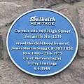 Plaque for James Martin Stagg CB OBE FRSE - geograph.org.uk - 6175360.jpg 1.335 × 1.333; 718 KB
-
 Powder mill (50288179692).jpg 4.016 × 6.015; 11,94 MB
-
 Power lines crossing Dalkeith Park - geograph.org.uk - 6079778.jpg 1.024 × 683; 327 KB
-
 Riponnensia splendens (female) - Flickr - S. Rae (9).jpg 1.100 × 920; 515 KB
-
 Road View - panoramio.jpg 2.592 × 1.944; 912 KB
-
 Road, Dalkeith Park - geograph.org.uk - 6079779.jpg 1.024 × 683; 271 KB
-
 Roslin, Midlothian - panoramio (1).jpg 3.888 × 2.592; 4,68 MB
-
 Roslin, Midlothian - panoramio.jpg 3.888 × 2.592; 4,92 MB
-
 Régen felvonóhíd volt itt (Once there was a drawbridge here) - panoramio.jpg 1.200 × 1.600; 958 KB
-
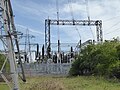 Smeaton Electricity Sub-station - geograph.org.uk - 6139559.jpg 640 × 480; 289 KB
-
 The entrance to Whitburgh House (geograph 2071775).jpg 1.024 × 768; 157 KB
-
 The path to Crichton Castle - panoramio.jpg 3.488 × 2.616; 2,17 MB
-
 The Peartree - panoramio.jpg 2.592 × 1.944; 726 KB
-
 The Stable Block, Dalkeith Park - geograph.org.uk - 6139534.jpg 640 × 480; 247 KB
-
 Sandy Knowe - geograph.org.uk - 175726.jpg 640 × 480; 66 KB
-
 Sheep pasture, Brothershiels. - geograph.org.uk - 175729.jpg 640 × 480; 80 KB
-

-
 Ösvény a vár felé (Path to the castle) - panoramio.jpg 1.200 × 1.600; 914 KB
_-_panoramio.jpg)
_-_panoramio.jpg)
_-_panoramio.jpg)


.jpg)


.jpg)
.jpg)

.jpg)
.jpg)

.jpg)
.jpg)
.jpg)


_-_panoramio.jpg)


.jpg)
.jpg)
.jpg)
.jpg)
.jpg)
.jpg)
.jpg)
.jpg)
.jpg)
.jpg)
.jpg)
.jpg)
.jpg)
.jpg)
.jpg)
.jpg)
.jpg)
.jpg)
.jpg)
.jpg)
.jpg)
.jpg)
.jpg)
.jpg)
.jpg)
.jpg)
.jpg)
.jpg)
.jpg)
.jpg)
.jpg)
.jpg)
.jpg)
.jpg)


_-_panoramio.jpg)

.jpg)

_-_Flickr_-_S._Rae_(9).jpg)


.jpg)

_-_panoramio.jpg)

.jpg)


_-_panoramio.jpg)
_-_panoramio.jpg)
.jpg)