Category:Clackmannanshire
Направо към навигацията
Направо към търсенето
Council areas (municipalities) of Scotland: Aberdeen · Aberdeenshire · Angus · Argyll and Bute · Clackmannanshire · Dumfries and Galloway · Dundee · East Ayrshire · East Dunbartonshire · East Lothian · East Renfrewshire · Edinburgh · Falkirk · Fife · Glasgow · Highland · Inverclyde · Midlothian · Moray · North Ayrshire · North Lanarkshire · Outer Hebrides · Orkney Islands · Perth and Kinross · Renfrewshire · Scottish Borders · Shetland Islands · South Ayrshire · South Lanarkshire · Stirling · West Dunbartonshire · West Lothian
Traditional counties (shires) of Scotland: Aberdeenshire · Angus · Argyll · Ayrshire · Banffshire · Berwickshire · Buteshire · Caithness · Clackmannanshire · Cromartyshire · Dumbartonshire · Dumfriesshire · East Lothian · Fife · Inverness-shire · Kincardineshire · Kinross-shire · Kirkcudbrightshire · Lanarkshire · Midlothian · Moray · Nairnshire · Orkney Islands · Peeblesshire · Perthshire · Renfrewshire · Ross-shire · Roxburghshire · Selkirkshire · Shetland Islands · Stirlingshire · Sutherland · West Lothian · Wigtownshire
Scottish council area    | |||||
| Качване на файл | |||||
| Екземпляр на | |||||
|---|---|---|---|---|---|
| Местоположение |
| ||||
| Столица | |||||
| Население |
| ||||
| Площ |
| ||||
| официален уебсайт | |||||
 | |||||


Подкатегории
Показани са 23 от общо 23 подкатегории на тази категория.
A
- Aerial photographs of Clackmannanshire (0 К, 0 С, 18 Ф)
C
E
G
H
I
L
- Lord-Lieutenants of Clackmannanshire (0 К, 0 С, 1 Ф)
N
P
R
S
T
V
Файлове в категория „Clackmannanshire“
Показани са 37 от общо 37 файла в тази категория.
-
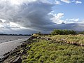
 Alongside the River Forth - geograph.org.uk - 5938579.jpg 1024 × 768; 149 КБ
-
 Approaching summit of King's Seat Hill - geograph.org.uk - 6244044.jpg 1024 × 768; 183 КБ
-
 Black Devon landfill site - geograph.org.uk - 2581829.jpg 640 × 359; 197 КБ
-
 Bruce Family Crest on their Tomb at Clackmannan Parish Graveyard 2017.jpg 1632 × 916; 640 КБ
-
 Burn of Sorrow - geograph.org.uk - 6156973.jpg 1024 × 768; 289 КБ
-
 Cannons on Mote Hill (geograph 5950838).jpg 1024 × 767; 235 КБ
-
 Clackmannan Cemetery - 1927.jpg 777 × 433; 151 КБ
-
 Clackmannan Cemetery.jpg 1632 × 916; 881 КБ
-
 Clackmannan Tollbooth 2017.jpg 911 × 1592; 320 КБ
-
 Clackmannan Tower View.jpg 1456 × 2592; 890 КБ
-
 Clackmannanshire Council election 2017.svg 866 × 516; 22 КБ
-
 Clackmannanshire District Council Achievement.png 393 × 567; 82 КБ
-
 Clacks arms.png 3685 × 4021; 1,4 МБ
-
 Coat of Arms of Clackmannanshire District Council 1975-1996.svg 495 × 701; 310 КБ
-
 Coat of arms of Clackmannanshire.svg 415 × 687; 304 КБ
-
 Confluence of the Black Devon and Forth - geograph.org.uk - 3624528.jpg 640 × 480; 225 КБ
-
 Dollar From Dollarbeg - panoramio.jpg 2713 × 1025; 1,92 МБ
-
 Dollar, Clackmannanshire (28372525100).jpg 3216 × 2136; 3,57 МБ
-
 Field boundary - geograph.org.uk - 3628223.jpg 640 × 480; 376 КБ
-
 Gate and stile on Whitewisp Hill - geograph.org.uk - 6156967.jpg 1024 × 768; 316 КБ
-
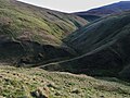
 Gate near the summit of Tarmangie Hill - geograph.org.uk - 6156970.jpg 1024 × 768; 293 КБ
-
 Gate on the Dollar to Glendevon path - geograph.org.uk - 6156959.jpg 1024 × 768; 382 КБ
-
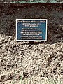 John Francon Williams 1854-1911 Commemorative Plaque.jpg 1516 × 2022; 1,34 МБ
-
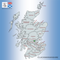 Map showing the traditional, geographical county of Clackmannanshire, Scotland.png 4967 × 4967; 6,77 МБ
-
 Mudflats and the River Forth - geograph.org.uk - 5938594.jpg 1024 × 768; 160 КБ
-
 Reedbed and Tullibody Inch - geograph.org.uk - 5877247.jpg 1024 × 768; 131 КБ
-
 River Forth - geograph.org.uk - 2581834.jpg 640 × 359; 208 КБ
-
 River Forth - geograph.org.uk - 2589163.jpg 640 × 359; 209 КБ
-
 River Forth near Kennet Pans - geograph.org.uk - 3627926.jpg 640 × 480; 370 КБ
-
 River Forth near Midtown - geograph.org.uk - 3120251.jpg 640 × 436; 270 КБ
-
 River Forth near Rhind - geograph.org.uk - 3453598.jpg 640 × 452; 289 КБ
-
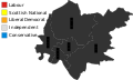
 Scotland Clackmannanshire Council 2022.svg 360 × 185; 2 КБ
-
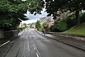
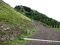 Silver Glen road (geograph 2579426).jpg 640 × 480; 282 КБ
-
 South Vennel Wall Inscription, Clackmannan 1828.jpg 1632 × 916; 803 КБ
-
 The Black Devon - geograph.org.uk - 3624862.jpg 640 × 480; 325 КБ
-
 Tillicoultry (29384487718).jpg 3104 × 1746; 1,59 МБ
-
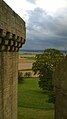
 View towards Stirling from Clackmannan Tower.jpg 1456 × 2592; 881 КБ


.jpg)


.jpg)


.jpg)


.jpg)
