Category:West Lothian
ナビゲーションに移動
検索に移動
Traditional counties (shires) of Scotland:Aberdeenshire · Angus · Argyll · Ayrshire · Banffshire · Berwickshire · Buteshire · Caithness · Clackmannanshire · Cromartyshire · Dumbartonshire · Dumfriesshire · East Lothian · Fife · Inverness-shire · Kincardineshire · Kinross-shire · Kirkcudbrightshire · Lanarkshire · Midlothian · Moray · Nairnshire · Orkney Islands · Peeblesshire · Perthshire · Renfrewshire · Ross-shire · Roxburghshire · Selkirkshire · Shetland Islands · Stirlingshire · Sutherland · West Lothian · Wigtownshire
Council areas (municipalities) of Scotland: Aberdeen · Aberdeenshire · Angus · Argyll and Bute · Clackmannanshire · Dumfries and Galloway · Dundee · East Ayrshire · East Dunbartonshire · East Lothian · East Renfrewshire · Edinburgh · Falkirk · Fife · Glasgow · Highland · Inverclyde · Midlothian · Moray · North Ayrshire · North Lanarkshire · Outer Hebrides · Orkney Islands · Perth and Kinross · Renfrewshire · Scottish Borders · Shetland Islands · South Ayrshire · South Lanarkshire · Stirling · West Dunbartonshire · West Lothian
スコットランドの州  | |||||
| メディアをアップロード | |||||
| 分類 | |||||
|---|---|---|---|---|---|
| 場所 |
| ||||
| 行政中心地 | |||||
| 立法府 |
| ||||
| 人口 |
| ||||
| 面積 |
| ||||
| 以下と異なる | |||||
 | |||||

See West Lothian
下位カテゴリ
このカテゴリに属する 27 個のサブカテゴリのうち、 27 個を表示しています。
A
- Aerial photographs of West Lothian (33ファイル)
B
C
D
- Drumshoreland Muir (7ファイル)
E
G
H
I
L
N
P
- Panoramics of West Lothian (17ファイル)
- Playgrounds in West Lothian (5ファイル)
S
- Snow in West Lothian (110ファイル)
T
V
W
- Westwood Shale Bing (5ファイル)
カテゴリ「West Lothian」にあるメディア
このカテゴリに属する 168 個のファイルのうち、 168 個を表示しています。
-
 'Christmas Trees' at Black Moss, Armadale, West Lothian - panoramio.jpg 2,448 × 3,264;1.54メガバイト
-
 'Crouching' stone. - panoramio.jpg 3,264 × 2,448;2.69メガバイト
-
 A closer look at Niddry Bing - panoramio.jpg 1,200 × 897;402キロバイト
-
 A70 road to Lanark - panoramio.jpg 2,816 × 1,880;2.07メガバイト
-
 A71 13th march 2010 - panoramio.jpg 2,816 × 1,880;1.86メガバイト
-
 Air Lingus Airbus A320-214 EI-DVE - panoramio.jpg 3,888 × 2,592;3.03メガバイト
-
 Almond river - panoramio.jpg 2,816 × 1,880;2.65メガバイト
-
 Approach to cycle path. Old railway juction, Armadale - panoramio.jpg 2,448 × 3,264;2.52メガバイト
-
 Armadale bricks used as foundations for the road - panoramio.jpg 2,448 × 3,264;2.77メガバイト
-
 Armadale, Bathgate EH48, UK - panoramio.jpg 3,264 × 2,448;2.71メガバイト
-
 Aspect from East Cairn Hill - panoramio.jpg 1,980 × 1,320;1.57メガバイト
-
 Atkinson lorry in Livingston. - panoramio.jpg 1,936 × 1,288;654キロバイト
-
 Auldcathie Church, West Lothian.jpg 2,880 × 2,160;1.09メガバイト
-
 Autumn North East Armadale - panoramio.jpg 2,335 × 1,761;799キロバイト
-
 Avenue of Rowan Trees in Hardhill Woods, Armadale - panoramio.jpg 3,264 × 2,448;2.86メガバイト
-
 B8046 near Old philpstoun - panoramio.jpg 1,600 × 1,200;639キロバイト
-
 Bathville Cottages - panoramio.jpg 2,725 × 1,387;1.96メガバイト
-
 Beach at Society Point - geograph.org.uk - 2456569.jpg 640 × 427;438キロバイト
-
 Beach, Firth of Forth - geograph.org.uk - 3641347.jpg 640 × 480;267キロバイト
-
 Beach, Wester Shore - geograph.org.uk - 3647256.jpg 640 × 480;263キロバイト
-

-
 Ben Lomond - panoramio.jpg 1,200 × 897;367キロバイト
-
 Blackmoss, a rare 'raised bog', in Armadale, West Lothian - panoramio.jpg 3,264 × 2,448;1.74メガバイト
-
 Blackness Castle - geograph.org.uk - 3647260.jpg 640 × 480;240キロバイト
-
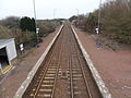
 Breich - Platform levels.JPG 4,608 × 3,456;3.58メガバイト
-
 Breich Railway Bridge - view towards Edinburgh.JPG 4,608 × 3,456;3.64メガバイト
-
 Breich Railway Station - view towards Glasgow.JPG 4,608 × 3,456;3.68メガバイト
-
 Bridgecastle from the Road - panoramio.jpg 3,264 × 1,836;4.1メガバイト
-
 Camilty Gunpowder Mill Ruins.jpg 3,737 × 3,024;6.1メガバイト
-
 Classic car . - panoramio.jpg 1,570 × 1,182;368キロバイト
-
 Classsic car in Livingston. - panoramio.jpg 1,570 × 1,182;411キロバイト
-
 Coat of arms of West Lothian Council.svg 980 × 814;682キロバイト
-
 Cycle path sculpture - panoramio.jpg 2,448 × 3,264;2.17メガバイト
-
 Dear Park roundabout - panoramio.jpg 2,816 × 1,880;2.23メガバイト
-
 Deer at Black Moss - panoramio.jpg 1,693 × 2,255;993キロバイト
-
 E M Horseburgh bus - panoramio.jpg 3,888 × 2,592;3.93メガバイト
-
 E M Horseburgh mini bus - panoramio.jpg 3,888 × 2,592;3.99メガバイト
-
 Eclipse going down on 21-12-2010. - panoramio.jpg 3,888 × 2,592;2.89メガバイト
-
 Eclipse on 21-12-2010 - panoramio.jpg 3,888 × 2,592;2.69メガバイト
-
 Entering Newton vilage - panoramio.jpg 2,048 × 1,536;880キロバイト
-
 Entrance of the Beecraigs Country Park, West Lothian.JPG 3,648 × 2,736;4.84メガバイト
-
 Farmer sowing seeds - panoramio.jpg 3,888 × 2,592;4.37メガバイト
-
 Firth of Forth foreshore - geograph.org.uk - 4582533.jpg 3,264 × 2,448;2.36メガバイト
-
 Five Sisters Bing seen from West Calder.jpg 4,032 × 3,024;2.41メガバイト
-
 Five Sisters shale bings Westlothian. - panoramio.jpg 1,570 × 1,045;177キロバイト
-
 Five Sisters shale bings. - panoramio.jpg 1,570 × 1,045;201キロバイト
-
 Five Sisters Westlothian. - panoramio.jpg 1,570 × 1,045;181キロバイト
-
 Foreshore at Society Point - geograph.org.uk - 5304681.jpg 3,264 × 2,448;2.45メガバイト
-
 Foreshore near Society - geograph.org.uk - 4582511.jpg 3,264 × 2,448;3.05メガバイト
-
 Forth Bridge - panoramio.jpg 1,200 × 897;443キロバイト
-
 Freeport Westlothian been empty for years. - panoramio.jpg 1,570 × 1,045;251キロバイト
-
 Frozen tree - panoramio - tormentor4555.jpg 2,048 × 1,536;822キロバイト
-
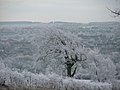 Frozen tree near Tippithill - panoramio.jpg 2,048 × 1,536;797キロバイト
-
 Garden in winter. - panoramio.jpg 1,275 × 956;417キロバイト
-
 Gardener's hut Bangour - panoramio.jpg 2,048 × 1,536;830キロバイト
-
 Glen Turner (Starlaw) Distillery.jpg 1,669 × 2,160;960キロバイト
-
 Globespan Boeing B737-800 G-DLCH - panoramio.jpg 2,816 × 1,880;887キロバイト
-
 Gorse bush on a Sunny day in April - panoramio.jpg 1,952 × 3,264;2.09メガバイト
-
 Grangemouth Refinery - panoramio.jpg 1,200 × 897;444キロバイト
-
 Greendykes road . - panoramio.jpg 1,570 × 1,045;179キロバイト
-
 Horse and foal. - panoramio.jpg 1,600 × 1,200;349キロバイト
-
 Horse at Woodend. - panoramio - tormentor4555.jpg 1,550 × 1,163;290キロバイト
-
 Horse at Woodend. - panoramio.jpg 1,550 × 1,163;377キロバイト
-
 Horses and mist - panoramio.jpg 3,064 × 2,434;2.45メガバイト
-
 Igneous rock - panoramio.jpg 1,200 × 897;511キロバイト
-
 John Deere - panoramio.jpg 3,888 × 2,592;4.37メガバイト
-
 Jonh Deere ^ Baler - panoramio.jpg 3,888 × 2,592;4.09メガバイト
-
 Linlithgow - 'The Prospect of their Maj'ties Palace of Linlithgow' (5372742542).jpg 4,615 × 2,896;2.67メガバイト
-
 Linlithgow - panoramio.jpg 1,200 × 900;236キロバイト
-
 Livingston Fire Station.jpg 2,880 × 2,160;1.78メガバイト
-
 Livingston Town centre.jpg 2,880 × 2,160;2.09メガバイト
-
 Longridge 'new' Railway Station - entrance.JPG 4,608 × 3,456;3.65メガバイト
-
 Longridge - course of old railway.JPG 4,608 × 3,456;3.66メガバイト
-
 Longridge Bridge over stream - detail-.JPG 4,604 × 3,452;7.24メガバイト
-
 Longridge rail bridge over road - southern side.JPG 4,602 × 3,448;6.59メガバイト
-
 Longridge rail bridge over road.JPG 4,426 × 3,200;5.84メガバイト
-
 Longridge Railway Station - site of road overbridge.JPG 4,608 × 3,456;5.77メガバイト
-
 Longridge Railway Station - station entrance area.JPG 4,608 × 3,456;3.64メガバイト
-
 Longridge Railway Station - trackbed looking towards Fauldhouse.JPG 4,496 × 3,302;5.19メガバイト
-
 Looking towards Rosyth from Binny Craig. - panoramio.jpg 2,048 × 1,536;846キロバイト
-
 M8 Motorway near Livingston - panoramio.jpg 3,888 × 2,592;4.29メガバイト
-
 M8 Road works - panoramio.jpg 3,888 × 2,592;4.57メガバイト
-
 M8 Road works 2nd September 2010 - panoramio.jpg 3,888 × 2,592;3.92メガバイト
-
 Morning Scotch Mist over Livingston - panoramio.jpg 3,264 × 1,952;1,002キロバイト
-
 Morton - panoramio.jpg 3,888 × 2,592;4.12メガバイト
-
 Morton Fisheries boats - panoramio.jpg 3,888 × 2,592;3.99メガバイト
-
 Morton Fishing lake - panoramio.jpg 3,888 × 2,592;3.91メガバイト
-
 Morton lake boats - panoramio.jpg 3,888 × 2,592;4.33メガバイト
-
 Mudflats east of Blackness - geograph.org.uk - 3901773.jpg 640 × 420;413キロバイト
-
 Near Former Site of Colinshiels Village - panoramio.jpg 3,264 × 2,448;1.37メガバイト
-
 New Aircraft Carrier parts at Rosyth - panoramio.jpg 3,008 × 2,000;1.22メガバイト
-
 Niddry Bing - panoramio.jpg 1,200 × 897;389キロバイト
-
 Northwest side of Blackmoss - panoramio.jpg 3,264 × 2,448;2.07メガバイト
-
 Nuffield - panoramio.jpg 1,600 × 1,132;360キロバイト
-
 Old Drainpipe - geograph.org.uk - 3404268.jpg 422 × 640;486キロバイト
-
 Old Farm Ruin. - panoramio - tormentor4555 (1).jpg 3,888 × 2,592;4.13メガバイト
-
 Old Farm Ruin. - panoramio - tormentor4555.jpg 3,888 × 2,592;3.86メガバイト
-
 Old farm Ruin. - panoramio.jpg 3,888 × 2,592;3.95メガバイト
-
 Old Farm Ruin. - panoramio.jpg 3,888 × 2,592;4.84メガバイト
-
 Old Road from Northrigg Road to Netherhouses (Black Dubs) Farm - panoramio.jpg 3,264 × 2,448;2.65メガバイト
-
 Part of Old Bangour hospital, It closed years ago. . - panoramio.jpg 2,048 × 1,536;829キロバイト
-
 Path at Ravencraig Woodland, near Bathgate - panoramio.jpg 1,952 × 3,264;3.56メガバイト
-
 Pentlands from A70 - panoramio.jpg 2,816 × 1,880;1.37メガバイト
-
 Perimeter fencing between Blackmoss and Buttries - panoramio.jpg 3,264 × 2,448;1.95メガバイト
-
 Perspective on the path between Buttries and Armadale Academy - panoramio.jpg 2,448 × 3,264;2.23メガバイト
-
 Poppy mound - panoramio.jpg 1,300 × 868;261キロバイト
-
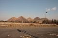
 Poppy on the M8 on Bathgate Pyramids is finished and now Looking great.. - panoramio (1).jpg 3,008 × 2,000;2.25メガバイト
-
 Poppy on the M8 on Bathgate Pyramids is finished and now Looking great.. - panoramio.jpg 3,008 × 2,000;2.7メガバイト
-
 Rail bridge over Union canal. - panoramio.jpg 2,816 × 1,880;1.34メガバイト
-
 Ravencraig Woodland Pond - panoramio.jpg 1,952 × 3,264;3.47メガバイト
-
 Road to Boghall Westlothian - panoramio.jpg 2,048 × 1,536;818キロバイト
-
 Road to Morton Fishing lake. - panoramio.jpg 3,888 × 2,592;6.65メガバイト
-
 Road works on the M8 - panoramio.jpg 3,888 × 2,592;3.87メガバイト
-
 Rocky Shore at Society - geograph.org.uk - 3404280.jpg 640 × 419;495キロバイト
-
 Rosyth Dockyard - geograph.org.uk - 5304671.jpg 3,264 × 2,448;1.87メガバイト
-
 Rowan Trees on old road from Northriggs Road to Netherhouses Farm, Armadale - panoramio.jpg 3,264 × 2,448;2.63メガバイト
-
 Ruin near Drumcross - panoramio.jpg 3,888 × 2,592;4.83メガバイト
-
 Ryanair B737 - panoramio.jpg 2,232 × 1,464;296キロバイト
-
 Ryanair B737 heading for Edinburgh Airport over Livingston. - panoramio.jpg 2,816 × 1,880;1.64メガバイト
-
 Scotland West Lothian Council 2022.svg 360 × 185;3キロバイト
-
 Scout Cairn, in front of 'amphitheatre', Hardhill Woods - panoramio.jpg 2,448 × 3,264;2.66メガバイト
-
 Scout's Cairn in Hardhill Woods, Armadale - panoramio.jpg 2,448 × 3,264;2.43メガバイト
-
 Sheep Toward Linlithgow Road - panoramio.jpg 3,264 × 2,448;2.1メガバイト
-
 Shire out in the snow - panoramio.jpg 2,816 × 1,880;2.3メガバイト
-
 Shire out in the snow. - panoramio.jpg 2,816 × 1,880;1.65メガバイト
-
 Shore at Society - geograph.org.uk - 3404260.jpg 640 × 419;424キロバイト
-
 Shore by the Midhope Burn - geograph.org.uk - 3253920.jpg 640 × 412;418キロバイト
-
 Simpson park way derelict house. - panoramio.jpg 1,570 × 1,045;270キロバイト
-
 Site of the former Buttries Pit, Armadale, West Lothian - panoramio.jpg 3,264 × 2,448;803キロバイト
-
 Snowplough at Breich xroads 13-03-2010 - panoramio.jpg 2,816 × 1,880;1.93メガバイト
-
 Society Beach - geograph.org.uk - 3404251.jpg 640 × 417;438キロバイト
-
 Society Point - geograph.org.uk - 2456560.jpg 640 × 423;364キロバイト
-
 Some where to rest. - panoramio.jpg 1,550 × 1,163;602キロバイト
-
 Sparkly mud puddles en route to former Buttries Pit. - panoramio.jpg 3,264 × 2,448;2.05メガバイト
-
 Stirrup Stane - panoramio.jpg 3,888 × 2,592;3.83メガバイト
-
 Stone causeway across tidal mudflats - geograph.org.uk - 5201206.jpg 3,277 × 1,966;4.8メガバイト
-
 Sunrise 19 dec 09 - panoramio.jpg 1,350 × 901;184キロバイト
-
 The Boar Stone, Armadale - panoramio.jpg 3,264 × 2,448;543キロバイト
-
 The Knock Stone Circle - panoramio.jpg 1,600 × 1,200;612キロバイト
-
 The three Forth Crossings (17172242795).jpg 4,928 × 1,337;865キロバイト
-
 The Tower Hill Building, Livingston.jpg 2,880 × 2,160;1.99メガバイト
-
 This boulder had an Elfin air of mystery and magic about it^ Blackmoss, Armadale - panoramio.jpg 3,264 × 2,448;2.15メガバイト
-
 This use to be the Old Bangour Green Keepers hut - panoramio.jpg 2,048 × 1,536;838キロバイト
-
 Three Bridges from near Society Point - geograph.org.uk - 5758702.jpg 640 × 427;94キロバイト
-
 Three Forth bridges from Society Point - geograph.org.uk - 5701312.jpg 3,601 × 2,161;5.34メガバイト
-
 Tiers. Path between Black Moss and Armadale Academy, looking west - panoramio.jpg 2,448 × 3,264;2.64メガバイト
-
 Tip - panoramio.jpg 3,264 × 2,448;1.54メガバイト
-
 Train to Glasgow - panoramio.jpg 1,200 × 897;458キロバイト
-
 Trees making a natural frame. Blackmoss, Armadale - panoramio.jpg 2,448 × 3,264;1.93メガバイト
-
 Trees on Horizon at Blackmoss, Armadale - panoramio.jpg 3,264 × 2,448;1.64メガバイト
-
 Triumph motor bike at Newton petrol stn - panoramio.jpg 2,816 × 2,120;1.46メガバイト
-
 Trying to takeaway the ashes from the bonfire. - panoramio.jpg 3,888 × 2,592;5.2メガバイト
-
 Twin Lambs at Drumcross - panoramio.jpg 3,888 × 2,592;4.98メガバイト
-
 Unnamed Burn - geograph.org.uk - 3901779.jpg 427 × 640;535キロバイト
-
 Viaduct near morton - panoramio.jpg 3,888 × 2,592;4.07メガバイト
-
 View from Binny Craig - panoramio.jpg 1,600 × 1,200;609キロバイト
-
 View north from Cauldstane Slap - panoramio.jpg 1,980 × 1,320;1.94メガバイト
-
 View North from Northrigg Road, near Stonerigg Farm, Armadale - panoramio.jpg 3,264 × 2,448;2.18メガバイト
-
 Walls of Slag - remains of mining industry in Armadale. - panoramio.jpg 3,264 × 2,448;3.02メガバイト
-
 West Lothian Map.png 4,967 × 4,967;6.8メガバイト
-
 West Lothian, UK - panoramio.jpg 1,200 × 897;360キロバイト
-
 Wester Drumcross - panoramio.jpg 3,888 × 2,592;5.4メガバイト
-
 Wester Shore - geograph.org.uk - 3901766.jpg 640 × 415;372キロバイト
-
 Wester Shore, Blackness - geograph.org.uk - 4159103.jpg 640 × 481;72キロバイト
-
 Winter 2010 Less we forget.. - panoramio.jpg 1,952 × 3,264;1.2メガバイト
-
 Winter Blossom - panoramio.jpg 739 × 1,024;505キロバイト
-
 Woodend Horse. - panoramio.jpg 1,550 × 1,163;514キロバイト
-
 Woodend horse. - panoramio.jpg 1,550 × 1,163;521キロバイト


.jpg)


_Distillery.jpg)


.jpg)


.jpg)


_Farm_-_panoramio.jpg)


.jpg)


.jpg)