Category:Shetland Islands
둘러보기로 이동
검색으로 이동
Council areas (municipalities) of Scotland: Aberdeen · Aberdeenshire · Angus · Argyll and Bute · Clackmannanshire · Dumfries and Galloway · Dundee · East Ayrshire · East Dunbartonshire · East Lothian · East Renfrewshire · Edinburgh · Falkirk · Fife · Glasgow · Highland · Inverclyde · Midlothian · Moray · North Ayrshire · North Lanarkshire · Outer Hebrides · Orkney Islands · Perth and Kinross · Renfrewshire · Scottish Borders · Shetland Islands · South Ayrshire · South Lanarkshire · Stirling · West Dunbartonshire · West Lothian
Traditional counties (shires) of Scotland: Aberdeenshire · Angus · Argyll · Ayrshire · Banffshire · Berwickshire · Buteshire · Caithness · Clackmannanshire · Cromartyshire · Dumbartonshire · Dumfriesshire · East Lothian · Fife · Inverness-shire · Kincardineshire · Kinross-shire · Kirkcudbrightshire · Lanarkshire · Midlothian · Moray · Nairnshire · Orkney Islands · Peeblesshire · Perthshire · Renfrewshire · Ross-shire · Roxburghshire · Selkirkshire · Shetland Islands · Stirlingshire · Sutherland · West Lothian · Wigtownshire
Former regions and island areas of Scotland: Central Region · Dumfries and Galloway · Fife · Grampian · Highland · Lothian · Orkney Islands · Outer Hebrides · Scottish Borders · Shetland Islands · Strathclyde · Tayside
subarctic archipelago, county and council area of Scotland that lies north-east of mainland Britain    | |||||
| 미디어 올리기 | |||||
| 다음 종류에 속함 |
| ||||
|---|---|---|---|---|---|
| 다음의 한 부분임 | |||||
| 위치 | 스코틀랜드 | ||||
| 다음 유역을 끼고 있음 | |||||
| 정부 소재지 | |||||
| 입법부 |
| ||||
| 공용어 | |||||
| 다음으로 이루어져 있음 | |||||
| 가장 높은 곳 | |||||
| 인구수 |
| ||||
| 면적 |
| ||||
| 다음과 다름 | |||||
| 공식 웹사이트 | |||||
 | |||||


하위 분류
다음은 이 분류에 속하는 하위 분류 35개 가운데 35개입니다.
"Shetland Islands" 분류에 속하는 미디어
다음은 이 분류에 속하는 파일 121개 가운데 121개입니다.
-
 A reef near Silwick - geograph.org.uk - 5011374.jpg 640 × 480; 174 KB
-
 Ayre Dyke - geograph.org.uk - 5130965.jpg 640 × 480; 176 KB
-
 Ayre Dyke near Houss - geograph.org.uk - 5130971.jpg 640 × 480; 161 KB
-
 Ayre of Breiwick, Wadbister Ness - geograph.org.uk - 3981364.jpg 1,024 × 681; 222 KB
-
 Ayre of Breiwick, Wadbister Ness - geograph.org.uk - 3981370.jpg 1,024 × 681; 217 KB
-
 Ayre of Breiwick, Wadbister Ness - geograph.org.uk - 3981382.jpg 1,024 × 681; 227 KB
-
 Beach at the head of the Bay of Deep Dale - geograph.org.uk - 4984493.jpg 1,600 × 1,200; 761 KB
-
 Beside Skerries of Easter Paill - geograph.org.uk - 5137383.jpg 1,600 × 1,201; 721 KB
-
 Bight of Vatsland - geograph.org.uk - 1922552.jpg 800 × 534; 128 KB
-
 Bird and Headlands - geograph.org.uk - 6516164.jpg 1,600 × 869; 227 KB
-
 Black Head - geograph.org.uk - 1974682.jpg 2,816 × 2,112; 916 KB
-
 Boats at The Taing - geograph.org.uk - 2586774.jpg 1,333 × 1,000; 1.02 MB
-
 Boats in the West Voe of Quarff - geograph.org.uk - 2066391.jpg 2,560 × 1,920; 1.9 MB
-
 Bridge between Trondra and Burra - geograph.org.uk - 6207033.jpg 800 × 533; 540 KB
-
 Burrier Head - geograph.org.uk - 1973532.jpg 2,816 × 2,112; 826 KB
-
 Callibanks on the Wester Sound - geograph.org.uk - 6182997.jpg 1,600 × 1,132; 390 KB
-
 Clifftops at Coall Head - geograph.org.uk - 2066147.jpg 2,560 × 1,920; 1.8 MB
-

-
 Coast of Lax Firth south of Otter Point - geograph.org.uk - 3981396.jpg 1,024 × 681; 210 KB
-
 Coast of Muckure - geograph.org.uk - 4011702.jpg 2,048 × 1,536; 1.53 MB
-
 Coastal grassland below The Hamar - geograph.org.uk - 5137335.jpg 1,600 × 1,201; 555 KB
-
 Coastal path near Houss - geograph.org.uk - 5130970.jpg 640 × 480; 182 KB
-
 Coastline at Score Head - geograph.org.uk - 3586694.jpg 640 × 480; 270 KB
-
 Coastline west of the Ness of Trebister - geograph.org.uk - 3573882.jpg 640 × 480; 187 KB
-
 Curious structure on the shoreline with its beach - geograph.org.uk - 6188083.jpg 1,600 × 1,200; 353 KB
-
 Detached Stack - geograph.org.uk - 2632737.jpg 4,058 × 2,918; 3.63 MB
-
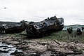 DM-ST-82-09940 Combat-ready Marines debark from two LVTP-7 during Northern Wedding.jpeg 2,840 × 1,890; 2.46 MB
-

-
 East coast of the Ness of Trebister - geograph.org.uk - 3573902.jpg 640 × 480; 156 KB
-
 East shore of Clift Sound - geograph.org.uk - 5733350.jpg 751 × 1,024; 190 KB
-
 Fish meal plant, Heogan - geograph.org.uk - 2709702.jpg 4,416 × 1,735; 470 KB
-
 Fore Holm - geograph.org.uk - 2614587.jpg 4,156 × 3,138; 4.55 MB
-
 Fore Holm north end - geograph.org.uk - 2612620.jpg 3,231 × 2,399; 3.18 MB
-
 From Bruna Ness towards Scalloway - geograph.org.uk - 5132863.jpg 1,600 × 1,201; 682 KB
-
 Fulmar (Fulmarus glacialis), South Ness, Foula - geograph.org.uk - 6332775.jpg 1,600 × 1,067; 131 KB
-
 Gaada Stack, Foula - geograph.org.uk - 6322414.jpg 1,600 × 900; 712 KB
-
 Gaada Stack, Foula - geograph.org.uk - 6336363.jpg 1,600 × 1,067; 240 KB
-
 Galta Stack - geograph.org.uk - 5044143.jpg 3,648 × 2,736; 3.65 MB
-
 Garderhouse pier - geograph.org.uk - 2860608.jpg 800 × 532; 127 KB
-
 Graveyard at Sound, Weisdale - geograph.org.uk - 4927711.jpg 1,024 × 682; 221 KB
-
 Greenholm - geograph.org.uk - 5923030.jpg 800 × 601; 411 KB
-
 Gro Stack from Wats Ness - geograph.org.uk - 1976767.jpg 2,816 × 2,112; 600 KB
-
 Gruna Isle - geograph.org.uk - 2277226.jpg 1,024 × 441; 73 KB
-
-
 Head of Garderhouse Voe - geograph.org.uk - 3795529.jpg 640 × 480; 246 KB
-
 Headland at Culswick Broch - geograph.org.uk - 2046807.jpg 2,560 × 1,920; 1.77 MB
-
 Heavy sea at Scaalie Point - geograph.org.uk - 5135591.jpg 1,600 × 1,200; 697 KB
-
 Holm Field from Houss, Burra - geograph.org.uk - 5095917.jpg 1,024 × 681; 129 KB
-
 Holm of Burrastow, near Walls - geograph.org.uk - 5318057.jpg 1,024 × 681; 154 KB
-
 Ingra Pund - geograph.org.uk - 2700370.jpg 600 × 800; 297 KB
-
 Keolki Field - geograph.org.uk - 2046642.jpg 2,560 × 1,920; 1.69 MB
-
 Kirka Ness and Kirk Holm - geograph.org.uk - 3472983.jpg 640 × 480; 56 KB
-
 Lang Sound - geograph.org.uk - 2706115.jpg 4,928 × 2,307; 1.06 MB
-
 Lang Sound from West Burra - geograph.org.uk - 1924145.jpg 800 × 534; 174 KB
-
 Loch of Vadill, seaward end - geograph.org.uk - 4618467.jpg 4,000 × 2,664; 3.51 MB
-
 Looking NW from Salt Ness - geograph.org.uk - 1971794.jpg 2,816 × 2,112; 2.63 MB
-

-
 Looking up Garderhouse Voe - geograph.org.uk - 3472994.jpg 640 × 480; 63 KB
-
 Looking west across Wick of Watsness - geograph.org.uk - 1976737.jpg 2,816 × 2,112; 618 KB
-
 Lunga Taing - geograph.org.uk - 6181230.jpg 1,600 × 1,144; 269 KB
-
 Moo Stack and the coast at Silwick - geograph.org.uk - 5010532.jpg 640 × 480; 171 KB
-
 Mousa Ness, Whiteness - geograph.org.uk - 2130470.jpg 800 × 534; 209 KB
-
 Mouth of Burri Geo - geograph.org.uk - 3838024.jpg 640 × 360; 212 KB
-
 Muckle Flaes, Ram's Head and Vaila Sound from the air - geograph.org.uk - 6323065.jpg 1,600 × 1,067; 376 KB
-
 Mussel rafts beside Burra Bridge - geograph.org.uk - 1924046.jpg 800 × 534; 128 KB
-
 Natural Arch at Point of Stakka - geograph.org.uk - 5134920.jpg 1,600 × 1,201; 489 KB
-
 Natural arch on the Ness of Trebister - geograph.org.uk - 3573890.jpg 640 × 480; 213 KB
-
 Near Scaalie Point, Houss Ness - geograph.org.uk - 5134942.jpg 1,600 × 1,201; 685 KB
-
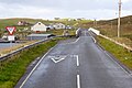
 Near the end of the road, in the Shetland Islands 1983 (50239958452).jpg 1,938 × 1,244; 618 KB
-
 Otter Point, Lax Firth - geograph.org.uk - 3981390.jpg 1,024 × 681; 175 KB
-
 Otter Point, Lax Firth - geograph.org.uk - 3981393.jpg 1,024 × 681; 221 KB
-
 Otter Point, Lax Firth - geograph.org.uk - 3981399.jpg 1,024 × 681; 214 KB
-
-
 Pictish Culswick Broch - geograph.org.uk - 2046759.jpg 2,560 × 1,920; 1.76 MB
-
 Pier at Laxfirth - geograph.org.uk - 2360434.jpg 800 × 534; 223 KB
-
 Piers for Mussel Farm - geograph.org.uk - 6207021.jpg 800 × 600; 563 KB
-
 Point of Russaness - geograph.org.uk - 2273632.jpg 2,136 × 2,848; 2.97 MB
-
 Point of the Ness of Trebister - geograph.org.uk - 3573893.jpg 640 × 480; 137 KB
-
 Reita Ness - geograph.org.uk - 3799807.jpg 640 × 480; 241 KB
-
 Rock stacks at Whale Wick - geograph.org.uk - 5133208.jpg 1,600 × 1,201; 731 KB
-
 Ruin, Bowayre - geograph.org.uk - 3795525.jpg 640 × 480; 297 KB
-
 Russa Ness, from the air - geograph.org.uk - 5763554.jpg 1,024 × 683; 129 KB
-
 Sand beach - geograph.org.uk - 2136898.jpg 640 × 427; 38 KB
-
 Scaalie Point, Houss Ness - geograph.org.uk - 5135580.jpg 1,600 × 1,201; 677 KB
-
 Shetland Crub - geograph.org.uk - 2622590.jpg 3,221 × 2,374; 2.4 MB
-
 Shetland marine surveying (8271057575).jpg 800 × 533; 221 KB
-
 Shetlands House (7316453270).jpg 2,981 × 1,790; 4.04 MB
-
 Skeo Taing - geograph.org.uk - 2609879.jpg 4,320 × 3,240; 5.55 MB
-
 Skerries of Easter Paill - geograph.org.uk - 5137348.jpg 1,600 × 1,201; 564 KB
-
 Skerry-hopping at Loder Head - geograph.org.uk - 5828850.jpg 3,200 × 1,600; 1.79 MB
-
 Skersund Skerry - geograph.org.uk - 3573898.jpg 640 × 480; 167 KB
-
 Small headland, Ayre of Breiwick, Wadbister Ness - geograph.org.uk - 3981385.jpg 1,024 × 681; 199 KB
-
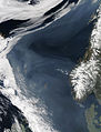 Smoke over the Norwegian Sea-2006-05-07 lrg.jpg 5,800 × 7,600; 4.41 MB
-
 South Voe - geograph.org.uk - 2052200.jpg 2,560 × 1,920; 1.91 MB
-
 South Voe and Holm of Papil - geograph.org.uk - 6201628.jpg 800 × 533; 532 KB
-
 South West tip of isle of Flotta - geograph.org.uk - 5987907.jpg 1,024 × 576; 180 KB
-
 Squidel and Clett - geograph.org.uk - 5011378.jpg 640 × 480; 170 KB
-
 Squidel near Silwick - geograph.org.uk - 5011373.jpg 640 × 480; 203 KB
-
 Stack of Sandwick, Burra, Shetland - geograph.org.uk - 5132867.jpg 1,600 × 1,201; 740 KB
-
 Stack on the Ness of Trebister - geograph.org.uk - 3573886.jpg 640 × 480; 196 KB
-
 Steis Point - geograph.org.uk - 1973552.jpg 2,816 × 2,112; 786 KB
-
 Stream Sound from West Burra - geograph.org.uk - 1924137.jpg 800 × 534; 133 KB
-
 The cliffs of Kirka Ness - geograph.org.uk - 3472988.jpg 640 × 480; 55 KB
-
 The Dragon Hus Camping Bod - geograph.org.uk - 6183028.jpg 1,600 × 1,200; 388 KB
-
 The Groni Stack - geograph.org.uk - 2277081.jpg 1,024 × 681; 135 KB
-
 The head of Garderhouse Voe, with scattered dwellings - geograph.org.uk - 3539093.jpg 1,600 × 1,200; 437 KB
-
 The island of Hoy, Weisdale Voe, from the air - geograph.org.uk - 5763226.jpg 1,024 × 1,024; 206 KB
-
 The mouth of the Houb, Grunnavoe, Walls - geograph.org.uk - 5318033.jpg 1,024 × 681; 93 KB
-
 The Nev - geograph.org.uk - 3838013.jpg 640 × 360; 244 KB
-
 The Nev - geograph.org.uk - 3838039.jpg 640 × 360; 223 KB
-
 The Taing - geograph.org.uk - 5130992.jpg 640 × 480; 154 KB
-
 Trailers parked at Scottie Holm - geograph.org.uk - 5831777.jpg 4,400 × 2,200; 1.91 MB
-
 Trolligarts 2.jpg 4,032 × 3,024; 3.93 MB
-
 Trolligarts.jpg 4,032 × 3,024; 3.28 MB
-
 Uni Firth and the Vadills - geograph.org.uk - 3488330.jpg 640 × 480; 74 KB
-
 Ved shetlandskysten.png 835 × 606; 506 KB
-
 Virda and West Voe of Quarff - geograph.org.uk - 2066413.jpg 2,560 × 1,920; 1.96 MB
-
 Watsness from Dog's Head - geograph.org.uk - 1976757.jpg 2,816 × 2,112; 767 KB
-
 West and East Burra - geograph.org.uk - 4505841.jpg 640 × 480; 218 KB
-
 West Voe, Holm of Houss - geograph.org.uk - 5923355.jpg 800 × 533; 622 KB
-
 West Voe, Peerie Holm of Clett - geograph.org.uk - 5923262.jpg 800 × 600; 500 KB


,_South_Ness,_Foula_-_geograph.org.uk_-_6332775.jpg)


.jpg)


.jpg)
.jpg)


