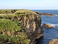
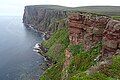
Category:Orkney Islands
Jump to navigation
Jump to search
Council areas (municipalities) of Scotland: Aberdeen · Aberdeenshire · Angus · Argyll and Bute · Clackmannanshire · Dumfries and Galloway · Dundee · East Ayrshire · East Dunbartonshire · East Lothian · East Renfrewshire · Edinburgh · Falkirk · Fife · Glasgow · Highland · Inverclyde · Midlothian · Moray · North Ayrshire · North Lanarkshire · Outer Hebrides · Orkney Islands · Perth and Kinross · Renfrewshire · Scottish Borders · Shetland Islands · South Ayrshire · South Lanarkshire · Stirling · West Dunbartonshire · West Lothian
Traditional counties (shires) of Scotland: Aberdeenshire · Angus · Argyll · Ayrshire · Banffshire · Berwickshire · Buteshire · Caithness · Clackmannanshire · Cromartyshire · Dumbartonshire · Dumfriesshire · East Lothian · Fife · Inverness-shire · Kincardineshire · Kinross-shire · Kirkcudbrightshire · Lanarkshire · Midlothian · Moray · Nairnshire · Orkney Islands · Peeblesshire · Perthshire · Renfrewshire · Ross-shire · Roxburghshire · Selkirkshire · Shetland Islands · Stirlingshire · Sutherland · West Lothian · Wigtownshire
Former regions and island areas of Scotland: Central Region · Dumfries and Galloway · Fife · Grampian · Highland · Lothian · Orkney Islands · Outer Hebrides · Scottish Borders · Shetland Islands · Strathclyde · Tayside
archipelago, county and council area in northern Scotland    | |||||
| Upload media | |||||
| Instance of |
| ||||
|---|---|---|---|---|---|
| Location | Scotland | ||||
| Located in or next to body of water | |||||
| Capital | |||||
| Has part(s) | |||||
| Highest point | |||||
| Population |
| ||||
| Area |
| ||||
| official website | |||||
 | |||||

Deutsch: Orkney sind Inseln, die zu Schottland gehören, und im Norden von Schottland liegen.
English: The Orkney Islands form one of 32 unitary council regions of Scotland, and are a Lieutenancy Area. The archipelago consists of about 200 small islands 16 kilometers north of Caithness in northern Scotland. The largest island in the group is known as "Mainland"; about 20 are inhabited in total.
Français : Les Îles Orcades (Orkney) forment une des 32 municipalités (council areas) de l’Écosse et sont une région de lieutenance et un comté traditionnel (shire). L’archipel comprend environ 200 petites îles et îlots à 16 kilomètres au nord de Caithness en Écosse du Nord. La plus grande île du groupe est connue comme « Mainland » (Terre principale) ; environ 20 d’entre elles sont habitées.
Norsk bokmål: Orknøyene er en av Skottlands 32 regioner og består av 200 øyer. Mainland (Hovedøya) er øygruppens største øy.
Polski: Orkady to archipelag na północ od wybrzeży Szkocji, na granicy Morza Północnego i otwartego Oceanu Atlantyckiego. W jego skład wchodzi 67 wysp o łącznej powierzchni 975 km².

Subcategories
This category has the following 28 subcategories, out of 28 total.
A
C
E
F
- Flags of the Orkney Islands (15 F)
G
H
N
- Nuckelavee (2 F)
O
- Orkney Islands Council (2 F)
P
S
T
Media in category "Orkney Islands"
The following 200 files are in this category, out of 623 total.
(previous page) (next page)-
 2018 07 12 Schottland (106).jpg 4,000 × 3,000; 4.93 MB
-
 2018 07 12 Schottland (108).jpg 3,000 × 4,000; 4.11 MB
-
 2018 07 12 Schottland (115).jpg 4,000 × 3,000; 4.94 MB
-
 2018 07 12 Schottland (117).jpg 4,000 × 3,000; 4.68 MB
-
 2018 07 12 Schottland (118).jpg 4,000 × 3,000; 4.85 MB
-
 2018 07 12 Schottland (120).jpg 4,000 × 3,000; 4.47 MB
-
 2018 07 12 Schottland (122).jpg 4,000 × 3,000; 4.69 MB
-
 2018 07 12 Schottland (125).jpg 4,000 × 3,000; 4.64 MB
-
 2018 07 12 Schottland (126).jpg 4,000 × 3,000; 4.7 MB
-
 2018 07 12 Schottland (127).jpg 4,000 × 3,000; 4.63 MB
-
 2018 07 12 Schottland (132).jpg 2,640 × 856; 733 KB
-
 2018 07 12 Schottland (133).jpg 4,000 × 3,000; 4.63 MB
-
 2018 07 12 Schottland (134).jpg 4,000 × 3,000; 4.57 MB
-
 2018 07 12 Schottland (137).jpg 4,000 × 3,000; 4.4 MB
-
 2018 07 12 Schottland (139).jpg 4,000 × 3,000; 4.71 MB
-
 2018 07 12 Schottland (140).jpg 4,000 × 3,000; 4.65 MB
-
 2018 07 12 Schottland (142).jpg 4,000 × 3,000; 4.44 MB
-
 2018 07 12 Schottland (17) Orkneys.jpg 4,000 × 3,000; 4.5 MB
-
 2018 07 12 Schottland (19).jpg 4,000 × 3,000; 4.62 MB
-
 2018 07 12 Schottland (20).jpg 4,000 × 3,000; 4.4 MB
-
 2018 07 12 Schottland (26).jpg 4,000 × 3,000; 4.62 MB
-
 2018 07 12 Schottland (27).jpg 4,000 × 3,000; 4.64 MB
-
 2018 07 12 Schottland (29).jpg 4,000 × 3,000; 4.48 MB
-
 2018 07 12 Schottland (30).jpg 4,000 × 3,000; 4.4 MB
-
 2018 07 12 Schottland (35).jpg 4,000 × 3,000; 4.71 MB
-
 2018 07 12 Schottland (36).jpg 4,000 × 3,000; 4.6 MB
-
 2018 07 12 Schottland (69).jpg 4,000 × 3,000; 4.59 MB
-
 2018 07 12 Schottland (70).jpg 4,000 × 3,000; 4.4 MB
-
 2018 07 12 Schottland (71).jpg 4,000 × 3,000; 4.48 MB
-
 2018 07 12 Schottland (82).jpg 3,344 × 856; 1.38 MB
-
 2018 07 12 Schottland (83).jpg 4,000 × 3,000; 4.74 MB
-
 2018 07 12 Schottland (85).jpg 4,000 × 3,000; 4.52 MB
-
 2018 07 12 Schottland (87).jpg 4,000 × 3,000; 4.75 MB
-
 2018 07 12 Schottland (88).jpg 4,000 × 3,000; 4.59 MB
-
 2018 07 12 Schottland (89).jpg 4,000 × 3,000; 4.68 MB
-
 A corner of Lamaness Firth - geograph.org.uk - 4576608.jpg 640 × 480; 473 KB
-
 A Loganair plane at Kirkwall Airport - geograph.org.uk - 6229476.jpg 6,000 × 4,000; 7.19 MB
-
 A965 alongside Loch of Stenness - geograph.org.uk - 5886699.jpg 1,600 × 1,059; 436 KB
-
 Abandoned houses - geograph.org.uk - 2221869.jpg 640 × 482; 48 KB
-
 Abandoned houses on Swona - geograph.org.uk - 3587200.jpg 3,575 × 2,384; 2.37 MB
-
 Abandoned houses on Swona - geograph.org.uk - 3592822.jpg 3,652 × 2,435; 1.75 MB
-
 Abandoned houses on the Isle of Swona - geograph.org.uk - 4483597.jpg 640 × 480; 415 KB
-
 Across Sty Wick - geograph.org.uk - 1927491.jpg 1,501 × 997; 1.06 MB
-
 Alien arrival, edge of daylight - geograph.org.uk - 4752349.jpg 3,716 × 2,973; 4.96 MB
-
 Alone at Waulkmill Sands - geograph.org.uk - 3488017.jpg 1,440 × 964; 303 KB
-
 An abandoned croft on Eynhallow - geograph.org.uk - 5702591.jpg 2,225 × 1,471; 957 KB
-
 Angle in the fence - geograph.org.uk - 3264301.jpg 1,500 × 963; 866 KB
-
 Anti-tank structures - geograph.org.uk - 4717066.jpg 4,180 × 3,345; 6.49 MB
-
 Approaching Bruce's Hole - geograph.org.uk - 2701297.jpg 1,000 × 652; 471 KB
-
 Arch, Noup Head - geograph.org.uk - 4326857.jpg 800 × 1,220; 200 KB
-
 Archeological Investigation - geograph.org.uk - 2316278.jpg 2,816 × 2,112; 3.79 MB
-
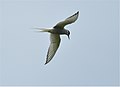 Arctic Tern - geograph.org.uk - 2469547.jpg 2,101 × 1,521; 1.36 MB
-

-
 Ayre of Westermill - geograph.org.uk - 3480711.jpg 640 × 424; 57 KB
-
 Barley field below East Moss - geograph.org.uk - 6243360.jpg 6,000 × 4,000; 4.6 MB
-
 Barley field near Greenwall - geograph.org.uk - 6233975.jpg 5,693 × 3,797; 2.93 MB
-
 Barley field near Greenwall - geograph.org.uk - 6233985.jpg 6,000 × 4,000; 4.33 MB
-
 Bay of Bomasty - geograph.org.uk - 3006638.jpg 4,059 × 2,353; 1.76 MB
-
 Bay of Burland - geograph.org.uk - 5840504.jpg 640 × 427; 330 KB
-
 Bay of Burland - geograph.org.uk - 5840507.jpg 640 × 427; 312 KB
-
 Bay of Burland - geograph.org.uk - 5840509.jpg 640 × 427; 331 KB
-
 Bay of Creekland - geograph.org.uk - 5815514.jpg 640 × 427; 340 KB
-
 Bay of Holland - geograph.org.uk - 3006849.jpg 3,589 × 3,325; 7.02 MB
-
 Bay of Moclett, Papa Westray - geograph.org.uk - 5517916.jpg 640 × 428; 47 KB
-
 Bay of Newark - geograph.org.uk - 5756150.jpg 1,024 × 683; 140 KB
-
 Bay of Newark - geograph.org.uk - 5756158.jpg 1,024 × 576; 134 KB
-
 Bay of Pierowall - geograph.org.uk - 2457429.jpg 1,024 × 682; 187 KB
-
 Bay of Skaill - geograph.org.uk - 2427182.jpg 1,024 × 556; 181 KB
-
 Bay of Tuquoy - geograph.org.uk - 2458916.jpg 1,024 × 681; 262 KB
-
 Bay of Tuquoy - geograph.org.uk - 2585678.jpg 2,816 × 2,112; 3.41 MB
-
 Beach and lochan, Outer Holm - geograph.org.uk - 5749817.jpg 1,024 × 576; 162 KB
-
 Beach and Sky - geograph.org.uk - 1927256.jpg 1,367 × 1,633; 1.13 MB
-
 Beach at Muckle Castle - geograph.org.uk - 3105099.jpg 1,024 × 768; 206 KB
-
 Beach at Newark Bay - geograph.org.uk - 2449380.jpg 1,000 × 648; 137 KB
-
 Beach at St Mary's - geograph.org.uk - 2048639.jpg 640 × 480; 79 KB
-
 Beach beside Churchill Barrier No. 4, Burray - geograph.org.uk - 6202581.jpg 1,600 × 1,065; 680 KB
-
 Beach by Weddell Sound - geograph.org.uk - 3480113.jpg 640 × 424; 78 KB
-
 Beach near Cleat - geograph.org.uk - 5750164.jpg 1,024 × 576; 262 KB
-
 Beach near Honeysgeo - geograph.org.uk - 5814165.jpg 640 × 427; 309 KB
-
 Beach of St Catherine's Bay, Stronsay - geograph.org.uk - 6263699.jpg 3,648 × 2,736; 2.1 MB
-
 Beach off Burray - geograph.org.uk - 6235551.jpg 6,000 × 4,000; 7.69 MB
-
 Beach, Bay of Newark - geograph.org.uk - 5756149.jpg 1,024 × 683; 235 KB
-
 Beach, Bay of Newark - geograph.org.uk - 5756151.jpg 1,024 × 683; 130 KB
-
 Beach, Bay of Newark - geograph.org.uk - 5756153.jpg 1,024 × 576; 120 KB
-
 Beach, Helliehow - geograph.org.uk - 5754695.jpg 1,024 × 576; 249 KB
-
 Beach, Pool of Cletts - geograph.org.uk - 5906848.jpg 1,024 × 683; 324 KB
-
 Beach, Roos Wick - geograph.org.uk - 5749533.jpg 1,024 × 576; 175 KB
-
 Beach, Sty Wick - geograph.org.uk - 5752899.jpg 1,024 × 683; 119 KB
-
 Beach, Whitemill Bay - geograph.org.uk - 5754636.jpg 1,024 × 683; 121 KB
-
 Beach, Whitemill Point - geograph.org.uk - 5754648.jpg 1,024 × 683; 336 KB
-
 Beached boat bear Coubister - geograph.org.uk - 3749107.jpg 3,872 × 2,592; 5.14 MB
-
 Below the Scapa Distillery - geograph.org.uk - 3488015.jpg 1,440 × 964; 390 KB
-
 Bio crop - Swanbister Farm - geograph.org.uk - 2310150.jpg 2,818 × 2,188; 2.57 MB
-
 Birsay Bay looking north towards Brough of Birsay - geograph.org.uk - 5923004.jpg 5,202 × 3,465; 3.53 MB
-
 Birsay Bay looking southwards - geograph.org.uk - 5923007.jpg 5,202 × 3,465; 3.47 MB
-
 Bis Geos - geograph.org.uk - 4327827.jpg 800 × 527; 84 KB
-
 Black Geo - geograph.org.uk - 3105133.jpg 1,000 × 667; 130 KB
-
 Black Geo Rose Ness - geograph.org.uk - 2726062.jpg 3,826 × 2,903; 3.26 MB
-
 Blockship on the Sound - geograph.org.uk - 3480027.jpg 640 × 424; 61 KB
-
 Bo Skerry - geograph.org.uk - 3105231.jpg 1,000 × 667; 149 KB
-
 Boardwalk - geograph.org.uk - 5841057.jpg 640 × 427; 384 KB
-
 Boulder Beach and Cormorants - geograph.org.uk - 3266119.jpg 1,500 × 988; 987 KB
-
 Boulder Beach and Creel Buoy - geograph.org.uk - 3266155.jpg 997 × 1,500; 1.06 MB
-
 Boulder Beach, Hunda - geograph.org.uk - 3264358.jpg 1,153 × 1,500; 988 KB
-
 Breakers, Orkney Islands (48106792736).jpg 2,639 × 1,755; 1,002 KB
-
 Brodgarstones.jpg 2,024 × 1,041; 1.23 MB
-
 Brough of Bigging - geograph.org.uk - 3912208.jpg 1,600 × 1,063; 420 KB
-
 Brough of Bigging, Yesnaby - geograph.org.uk - 3744430.jpg 1,024 × 768; 158 KB
-
 Brough of Deerness - geograph.org.uk - 5837315.jpg 1,024 × 686; 166 KB
-
 Brough of Deerness - geograph.org.uk - 5837319.jpg 1,024 × 686; 180 KB
-
 Brough of Deerness - geograph.org.uk - 5837325.jpg 1,024 × 685; 104 KB
-
 Brough of Deerness from White Fowl Nevi - geograph.org.uk - 3109119.jpg 1,024 × 768; 193 KB
-
 Bruce's Hole - geograph.org.uk - 2701314.jpg 650 × 1,000; 510 KB
-
 Bruce's Hole - geograph.org.uk - 2701342.jpg 1,000 × 672; 566 KB
-
 BucklesTower1900s.jpg 640 × 486; 60 KB
-
 Buildings on Swona - geograph.org.uk - 5806770.jpg 1,024 × 574; 79 KB
-
 Burn on Hunda - geograph.org.uk - 3264308.jpg 1,500 × 962; 785 KB
-
 Burn, Kirkhouse - geograph.org.uk - 5906856.jpg 1,024 × 1,024; 406 KB
-
 Burray - geograph.org.uk - 4732396.jpg 800 × 600; 192 KB
-
 Burray - Western Peninsula with Churchill Barrier No.4 - geograph.org.uk - 2655892.jpg 1,000 × 1,333; 815 KB
-
 Burrian Broch - geograph.org.uk - 1927049.jpg 525 × 349; 140 KB
-
 Cairn, Holms of Ire, Sanday, Orkney - geograph.org.uk - 4336564.jpg 1,363 × 1,094; 324 KB
-
 Cairn, Inner Holm - geograph.org.uk - 5749621.jpg 1,024 × 576; 168 KB
-
 Calf of Cava - geograph.org.uk - 5815867.jpg 640 × 382; 215 KB
-
 Car park and public conveniences, Taracliff Bay - geograph.org.uk - 3101296.jpg 1,024 × 768; 249 KB
-
 Castle o' Burrian - geograph.org.uk - 5841072.jpg 640 × 427; 330 KB
-
 Castle o' Burrian - geograph.org.uk - 5841075.jpg 640 × 427; 357 KB
-
 Cattle above Little Hunclett - geograph.org.uk - 6244753.jpg 6,000 × 4,000; 4.78 MB
-
 Cattle coming my way at Hilltoft - geograph.org.uk - 6244695.jpg 6,000 × 4,000; 4.69 MB
-
 Cattle near Hestwall - geograph.org.uk - 6243294.jpg 6,000 × 4,000; 7.59 MB
-
 Cattle near West Waterhall - geograph.org.uk - 6247327.jpg 6,000 × 4,000; 4.29 MB
-
 Cattle on Heathery Howes - geograph.org.uk - 6245507.jpg 6,000 × 4,000; 4.17 MB
-
 Cattle on Lang Hill - geograph.org.uk - 6246311.jpg 5,720 × 3,816; 4.01 MB
-
 Causeway to Holm of Grimbister - geograph.org.uk - 3671650.jpg 3,872 × 2,592; 4.93 MB
-
 Causeway To Hunda - geograph.org.uk - 4007153.jpg 2,520 × 1,866; 1.94 MB
-
 Cava Light from the ferry - geograph.org.uk - 5032462.jpg 1,600 × 901; 264 KB
-

-

-
 Choices - Helzie - geograph.org.uk - 2871097.jpg 2,048 × 1,536; 874 KB
-
 Christmas Colour - geograph.org.uk - 3266172.jpg 1,500 × 1,021; 1.03 MB
-
 Churchill Barrier No. 3 - geograph.org.uk - 6173836.jpg 3,648 × 2,432; 2.25 MB
-
 Churchill Barrier no. 4, Burray - geograph.org.uk - 6202490.jpg 1,600 × 1,065; 308 KB
-
 Clett of Crurar - geograph.org.uk - 4367462.jpg 3,008 × 2,000; 2.79 MB
-
 Cliff path north of Marwick Head - geograph.org.uk - 3111382.jpg 1,024 × 768; 182 KB
-
 Cliffs above Den Wick - geograph.org.uk - 3622778.jpg 3,872 × 2,592; 4.98 MB
-
 Cliffs at Costa Head - geograph.org.uk - 2561561.jpg 800 × 600; 128 KB
-
 Cliffs at Ham Geo - geograph.org.uk - 3105150.jpg 667 × 1,000; 103 KB
-
 Cliffs by Saaclay - geograph.org.uk - 3495126.jpg 424 × 640; 98 KB
-
 Cliffs in Deerness - geograph.org.uk - 3155265.jpg 2,048 × 1,536; 1.03 MB
-
 Cliffs near Vat of Kirbuster - geograph.org.uk - 6263727.jpg 3,648 × 2,736; 2.18 MB
-
 Cliffs of Hoy - geograph.org.uk - 2223857.jpg 640 × 480; 118 KB
-
 Cliffs of Hoy - geograph.org.uk - 5815058.jpg 640 × 427; 336 KB
-
 Clifftop on Lamb Holm - geograph.org.uk - 6228700.jpg 6,000 × 4,000; 6.59 MB
-
 Clifftop View - geograph.org.uk - 1928216.jpg 1,093 × 1,881; 1.43 MB
-
 Closer view of the Holm of Boray - geograph.org.uk - 3710869.jpg 3,872 × 2,592; 1.08 MB
-
 Cloven Ayre - geograph.org.uk - 2727729.jpg 3,601 × 2,803; 3.17 MB
-
 Cloven Ayre noust - geograph.org.uk - 2727741.jpg 4,000 × 3,000; 4.82 MB
-
 Coast by The Grud - geograph.org.uk - 6231694.jpg 5,699 × 3,800; 4.54 MB
-
 Coastal Moorland, Hunda - geograph.org.uk - 3264295.jpg 1,500 × 973; 725 KB
-
 Coastal Moorland, Hunda - geograph.org.uk - 3264340.jpg 1,500 × 993; 944 KB
-
 Coastal pasture at The Breck - geograph.org.uk - 5680516.jpg 1,600 × 1,066; 332 KB
-
 Coastal path near Russa Taing - geograph.org.uk - 3718394.jpg 3,872 × 2,592; 5.97 MB
-
 Coastal path near Swin Ber - geograph.org.uk - 3622765.jpg 3,872 × 2,592; 5.27 MB
-
 Coastal path, Harrabrough Head - geograph.org.uk - 2783016.jpg 1,000 × 645; 443 KB
-
 Coastal View Near North Ronaldsay Pier - geograph.org.uk - 4091212.jpg 3,264 × 2,448; 3.87 MB
-
 Coastline at The Croos, Sanday, Orkney - geograph.org.uk - 3928752.jpg 1,459 × 896; 228 KB
-
 Coastline below Skea Hill, Westray, Orkney - geograph.org.uk - 4714320.jpg 1,438 × 1,067; 202 KB
-
 Coastline by Skirvil Taing - geograph.org.uk - 2680772.jpg 1,000 × 652; 491 KB
-
 Coastline near Coubister - geograph.org.uk - 3749103.jpg 3,872 × 2,592; 1.9 MB
-
 Coastline near Holm Taing - geograph.org.uk - 2680830.jpg 1,000 × 623; 507 KB
-
 Coastline near North Taing, Auskerry - geograph.org.uk - 2854296.jpg 1,000 × 648; 515 KB
-
 Coastline near Russa Taing - geograph.org.uk - 3718380.jpg 3,872 × 2,592; 5.32 MB
-
 Coastline, Egilsay, Orkney - geograph.org.uk - 3197059.jpg 480 × 640; 179 KB
-
 Coastline, Wyre, Orkney - geograph.org.uk - 2983244.jpg 640 × 480; 107 KB
-
 Coltsfoot view - geograph.org.uk - 2317241.jpg 3,648 × 2,736; 5.29 MB
-
 Copinsay from the east - geograph.org.uk - 4990413.jpg 1,024 × 682; 71 KB
-
 Copinsay, sunset over the lighthouse - geograph.org.uk - 3831960.jpg 640 × 481; 25 KB
-
 Corner of the field - geograph.org.uk - 2680847.jpg 1,000 × 695; 522 KB
-
 Cott, near Cleaton House - geograph.org.uk - 2585657.jpg 2,272 × 1,704; 286 KB
-
 Cove at Saaclay - geograph.org.uk - 5841067.jpg 640 × 427; 338 KB
-
 Craw Howe - geograph.org.uk - 6246331.jpg 6,000 × 4,000; 5.26 MB
-
 Craw Nev - geograph.org.uk - 5841048.jpg 480 × 640; 440 KB
-
 Creels, Pool of Cletts - geograph.org.uk - 5909383.jpg 1,024 × 1,024; 576 KB
-
 Cumla Geo - geograph.org.uk - 4367327.jpg 2,651 × 1,893; 2.44 MB
-
 Curious Cormorants. - geograph.org.uk - 3264214.jpg 1,500 × 904; 756 KB
-
 Damsay Chapel (St.Mary's) - geograph.org.uk - 2384507.jpg 4,320 × 3,240; 5.01 MB
-
 Damsay North-east corner - geograph.org.uk - 2384556.jpg 4,320 × 3,240; 4.44 MB
-
 Damsay Ruin inside - geograph.org.uk - 2384671.jpg 4,320 × 3,240; 5.66 MB
-
 Dig on Brough of Deerness, July 2009 - geograph.org.uk - 3004092.jpg 2,304 × 1,728; 2.2 MB
-
 Doun Helzie - geograph.org.uk - 5748658.jpg 1,024 × 576; 277 KB
-
 Dozing seal in Sands Geo - geograph.org.uk - 2322152.jpg 3,564 × 2,601; 4.62 MB
-
 Drainage channel - geograph.org.uk - 6243339.jpg 6,000 × 4,000; 5.21 MB
-
 Drainage channel near Craw Howe - geograph.org.uk - 6246359.jpg 6,000 × 4,000; 5.21 MB
-
 Drainage channel on Heathery Howes - geograph.org.uk - 6245535.jpg 6,000 × 4,000; 5.8 MB
-
 Dunes by Churchill Barrier - geograph.org.uk - 3480761.jpg 640 × 424; 85 KB
-
 Dunes by Churchill Barrier No. 4 - geograph.org.uk - 6235559.jpg 6,000 × 4,000; 4.61 MB
-
 Dunes, Cara - geograph.org.uk - 4732385.jpg 800 × 600; 244 KB
-
 Dyke with lichen, The Hope, Hunda - geograph.org.uk - 3264130.jpg 3,008 × 2,000; 2.69 MB
-
 East Ayre and Hunda Sound - geograph.org.uk - 3266162.jpg 1,500 × 1,016; 858 KB
-
 East coast of Inner Holm - geograph.org.uk - 5749821.jpg 1,024 × 576; 216 KB
.jpg)
.jpg)
.jpg)
.jpg)
.jpg)
.jpg)
.jpg)
.jpg)
.jpg)
.jpg)
.jpg)
.jpg)
.jpg)
.jpg)
.jpg)
.jpg)
_Orkneys.jpg)
.jpg)
.jpg)
.jpg)
.jpg)
.jpg)
.jpg)
.jpg)
.jpg)
.jpg)
.jpg)
.jpg)
.jpg)
.jpg)
.jpg)
.jpg)
.jpg)


.jpg)


_-_geograph.org.uk_-_2384507.jpg)


.jpg)
.jpg)