Category:Orkney Islands
Jump to navigation
Jump to search
Council areas (municipalities) of Scotland: Aberdeen · Aberdeenshire · Angus · Argyll and Bute · Clackmannanshire · Dumfries and Galloway · Dundee · East Ayrshire · East Dunbartonshire · East Lothian · East Renfrewshire · Edinburgh · Falkirk · Fife · Glasgow · Highland · Inverclyde · Midlothian · Moray · North Ayrshire · North Lanarkshire · Outer Hebrides · Orkney Islands · Perth and Kinross · Renfrewshire · Scottish Borders · Shetland Islands · South Ayrshire · South Lanarkshire · Stirling · West Dunbartonshire · West Lothian
Traditional counties (shires) of Scotland: Aberdeenshire · Angus · Argyll · Ayrshire · Banffshire · Berwickshire · Buteshire · Caithness · Clackmannanshire · Cromartyshire · Dumbartonshire · Dumfriesshire · East Lothian · Fife · Inverness-shire · Kincardineshire · Kinross-shire · Kirkcudbrightshire · Lanarkshire · Midlothian · Moray · Nairnshire · Orkney Islands · Peeblesshire · Perthshire · Renfrewshire · Ross-shire · Roxburghshire · Selkirkshire · Shetland Islands · Stirlingshire · Sutherland · West Lothian · Wigtownshire
Former regions and island areas of Scotland: Central Region · Dumfries and Galloway · Fife · Grampian · Highland · Lothian · Orkney Islands · Outer Hebrides · Scottish Borders · Shetland Islands · Strathclyde · Tayside
archipelago, county and council area in northern Scotland    | |||||
| Upload media | |||||
| Instance of |
| ||||
|---|---|---|---|---|---|
| Location | Scotland | ||||
| Located in or next to body of water | |||||
| Capital | |||||
| Has part(s) | |||||
| Highest point | |||||
| Population |
| ||||
| Area |
| ||||
| official website | |||||
 | |||||

Deutsch: Orkney sind Inseln, die zu Schottland gehören, und im Norden von Schottland liegen.
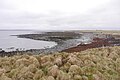
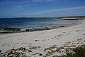
English: The Orkney Islands form one of 32 unitary council regions of Scotland, and are a Lieutenancy Area. The archipelago consists of about 200 small islands 16 kilometers north of Caithness in northern Scotland. The largest island in the group is known as "Mainland"; about 20 are inhabited in total.
Français : Les Îles Orcades (Orkney) forment une des 32 municipalités (council areas) de l’Écosse et sont une région de lieutenance et un comté traditionnel (shire). L’archipel comprend environ 200 petites îles et îlots à 16 kilomètres au nord de Caithness en Écosse du Nord. La plus grande île du groupe est connue comme « Mainland » (Terre principale) ; environ 20 d’entre elles sont habitées.
Norsk bokmål: Orknøyene er en av Skottlands 32 regioner og består av 200 øyer. Mainland (Hovedøya) er øygruppens største øy.
Polski: Orkady to archipelag na północ od wybrzeży Szkocji, na granicy Morza Północnego i otwartego Oceanu Atlantyckiego. W jego skład wchodzi 67 wysp o łącznej powierzchni 975 km².

Subcategories
This category has the following 28 subcategories, out of 28 total.
A
C
E
F
- Flags of the Orkney Islands (15 F)
G
H
N
- Nuckelavee (2 F)
O
- Orkney Islands Council (3 F)
P
S
T
Media in category "Orkney Islands"
The following 200 files are in this category, out of 406 total.
(previous page) (next page)-
 Arctic skua.jpg 4,192 × 3,144; 1.88 MB
-
 Black gulliemont.jpg 5,152 × 3,864; 5.01 MB
-
 Bruce's Hole - geograph.org.uk - 2701314.jpg 650 × 1,000; 510 KB
-
 Bruce's Hole - geograph.org.uk - 2701342.jpg 1,000 × 672; 566 KB
-
 Burrian Broch - geograph.org.uk - 1927049.jpg 525 × 349; 140 KB
-
 Cattle on Lang Hill - geograph.org.uk - 6246311.jpg 5,720 × 3,816; 4.01 MB
-
 Causeway to Holm of Grimbister - geograph.org.uk - 3671650.jpg 3,872 × 2,592; 4.93 MB
-
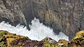 Caves in raging seas - geograph.org.uk - 6381289.jpg 1,600 × 900; 368 KB
-
 Christmas Colour - geograph.org.uk - 3266172.jpg 1,500 × 1,021; 1.03 MB
-
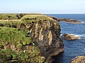
 Cliffs above Den Wick - geograph.org.uk - 3622778.jpg 3,872 × 2,592; 4.98 MB
-
 Cliffs at Ham Geo - geograph.org.uk - 3105150.jpg 667 × 1,000; 103 KB
-
 Cliffs by Saaclay - geograph.org.uk - 3495126.jpg 424 × 640; 98 KB
-
 Cliffs near Vat of Kirbuster - geograph.org.uk - 6263727.jpg 3,648 × 2,736; 2.18 MB
-
 Cloven Ayre noust - geograph.org.uk - 2727741.jpg 4,000 × 3,000; 4.82 MB
-
 Coast below Smithquoy - geograph.org.uk - 6314612.jpg 5,814 × 3,873; 2.7 MB
-
 Coast by The Grud - geograph.org.uk - 6231694.jpg 5,699 × 3,800; 4.54 MB
-
 Coastal field near Cubbigeo - geograph.org.uk - 6312066.jpg 5,835 × 3,887; 3.67 MB
-
 Coastal pasture at The Breck - geograph.org.uk - 5680516.jpg 1,600 × 1,066; 332 KB
-
 Coastal path near Russa Taing - geograph.org.uk - 3718394.jpg 3,872 × 2,592; 5.97 MB
-
 Coastal path near Swin Ber - geograph.org.uk - 3622765.jpg 3,872 × 2,592; 5.27 MB
-
 Coastal path, Harrabrough Head - geograph.org.uk - 2783016.jpg 1,000 × 645; 443 KB
-
 Coastal View Near North Ronaldsay Pier - geograph.org.uk - 4091212.jpg 3,264 × 2,448; 3.87 MB
-
 Coastline by Skirvil Taing - geograph.org.uk - 2680772.jpg 1,000 × 652; 491 KB
-
 Coastline near Coubister - geograph.org.uk - 3749103.jpg 3,872 × 2,592; 1.9 MB
-
 Coastline near Holm Taing - geograph.org.uk - 2680830.jpg 1,000 × 623; 507 KB
-
 Coastline near Russa Taing - geograph.org.uk - 3718380.jpg 3,872 × 2,592; 5.32 MB
-
 Coastline, Wyre, Orkney - geograph.org.uk - 2983244.jpg 640 × 480; 107 KB
-
 Coltsfoot view - geograph.org.uk - 2317241.jpg 3,648 × 2,736; 5.29 MB
-
 Copinsay from the east - geograph.org.uk - 4990413.jpg 1,024 × 682; 71 KB
-
 Copinsay, sunset over the lighthouse - geograph.org.uk - 3831960.jpg 640 × 481; 25 KB
-
 Corner of the field - geograph.org.uk - 2680847.jpg 1,000 × 695; 522 KB
-
 Cott, near Cleaton House - geograph.org.uk - 2585657.jpg 2,272 × 1,704; 286 KB
-
 Cove at Saaclay - geograph.org.uk - 5841067.jpg 640 × 427; 338 KB
-
 Craw Howe - geograph.org.uk - 6246331.jpg 6,000 × 4,000; 5.26 MB
-
 Craw Nev - geograph.org.uk - 5841048.jpg 480 × 640; 440 KB
-
 Creels, Pool of Cletts - geograph.org.uk - 5909383.jpg 1,024 × 1,024; 576 KB
-
 Cumla Geo - geograph.org.uk - 4367327.jpg 2,651 × 1,893; 2.44 MB
-
 Curious Cormorants. - geograph.org.uk - 3264214.jpg 1,500 × 904; 756 KB
-
 Cut grass near Thorn Farm - geograph.org.uk - 6313517.jpg 6,000 × 4,000; 4.1 MB
-
 Damsay Chapel (St.Mary's) - geograph.org.uk - 2384507.jpg 4,320 × 3,240; 5.01 MB
-
 Damsay North-east corner - geograph.org.uk - 2384556.jpg 4,320 × 3,240; 4.44 MB
-
 Damsay Ruin inside - geograph.org.uk - 2384671.jpg 4,320 × 3,240; 5.66 MB
-
 Dark wood - geograph.org.uk - 6288932.jpg 4,320 × 3,240; 5.43 MB
-
 Different grasses by the Loch of Swartmill - geograph.org.uk - 6314627.jpg 6,000 × 4,000; 4.91 MB
-
 Dig on Brough of Deerness, July 2009 - geograph.org.uk - 3004092.jpg 2,304 × 1,728; 2.2 MB
-
 Doun Helzie - geograph.org.uk - 5748658.jpg 1,024 × 576; 277 KB
-
 Dozing seal in Sands Geo - geograph.org.uk - 2322152.jpg 3,564 × 2,601; 4.62 MB
-
 Drainage channel - geograph.org.uk - 6243339.jpg 6,000 × 4,000; 5.21 MB
-
 Drainage channel near Craw Howe - geograph.org.uk - 6246359.jpg 6,000 × 4,000; 5.21 MB
-
 Drainage channel near Cubbigeo - geograph.org.uk - 6312588.jpg 5,835 × 3,887; 4.39 MB
-
 Drainage channel near Einor - geograph.org.uk - 6311056.jpg 6,000 × 4,000; 4.56 MB
-
 Drainage channel near Lochside - geograph.org.uk - 6316438.jpg 6,000 × 4,000; 4.02 MB
-
 Drainage channel on Heathery Howes - geograph.org.uk - 6245535.jpg 6,000 × 4,000; 5.8 MB
-
 Dunes by Churchill Barrier - geograph.org.uk - 3480761.jpg 640 × 424; 85 KB
-
 East Ayre and Hunda Sound - geograph.org.uk - 3266162.jpg 1,500 × 1,016; 858 KB
-
 East coast of Inner Holm - geograph.org.uk - 5749821.jpg 1,024 × 576; 216 KB
-
 East side of Tres Ness - geograph.org.uk - 5755760.jpg 1,024 × 683; 311 KB
-
 East Sous - geograph.org.uk - 5841105.jpg 640 × 446; 304 KB
-
 Effigy above Little Hunclett - geograph.org.uk - 6244747.jpg 6,000 × 4,000; 4.08 MB
-
 Eider ducks.jpg 4,192 × 3,144; 2.54 MB
-
 Entrance to Hole of the Ness - geograph.org.uk - 2701646.jpg 1,000 × 665; 540 KB
-
 European shag.jpg 5,152 × 3,864; 4.28 MB
-
 Fulmar (Papa Westray).jpg 5,152 × 3,864; 8.4 MB
-
 Fulzie Geo, Graemsay, Orkney - geograph.org.uk - 6415413.jpg 2,058 × 1,172; 594 KB
-
 Galt Skerry Navigation Buoy - geograph.org.uk - 3489079.jpg 640 × 480; 90 KB
-
 Galtness Coastal Gun Battery - geograph.org.uk - 3490614.jpg 640 × 480; 76 KB
-
 Geos on the western side of Mull Head - geograph.org.uk - 3622748.jpg 3,872 × 2,592; 3.81 MB
-
 Glasgow Highlands Orkney 1355.jpg 3,744 × 5,616; 12.21 MB
-
 Graemeshall Burn - geograph.org.uk - 3660469.jpg 3,872 × 2,592; 4.92 MB
-
 Graemsay ferry at Moaness Pier - geograph.org.uk - 2524031.jpg 1,600 × 1,158; 308 KB
-
 Grazing land on White Moss - geograph.org.uk - 6245513.jpg 6,000 × 4,000; 4.51 MB
-
 Great Auk Memorial - geograph.org.uk - 4589771.jpg 1,024 × 768; 318 KB
-
 Great auk statue.jpg 5,152 × 3,864; 7.37 MB
-
 Grip of Cleaton - geograph.org.uk - 3492522.jpg 640 × 480; 75 KB
-
 Grobust - geograph.org.uk - 3491937.jpg 640 × 480; 40 KB
-
 Grobust Bay - geograph.org.uk - 3491966.jpg 640 × 480; 74 KB
-
 Grobust Beach - geograph.org.uk - 3491929.jpg 640 × 480; 36 KB
-
 Grobust Beach - geograph.org.uk - 3720077.jpg 3,872 × 2,592; 1.3 MB
-

-
 Grobust Beach from the Knowe of Queen o' Howe - geograph.org.uk - 3720082.jpg 3,872 × 2,592; 2.08 MB
-
 Grobust looking west from Mis Skerries - geograph.org.uk - 2427272.jpg 1,024 × 673; 187 KB
-
 Grobust, Westray - geograph.org.uk - 2434937.jpg 1,024 × 561; 157 KB
-
 Group of fulmar.jpg 5,152 × 3,864; 5.68 MB
-
 Gutterpool - geograph.org.uk - 6243376.jpg 6,000 × 4,000; 6.13 MB
-
 Haco's Ness and Bay of Sandgarth, Shapinsay - geograph.org.uk - 3549609.jpg 1,024 × 683; 95 KB
-
 Harbour at Tingwell - geograph.org.uk - 3744448.jpg 1,024 × 768; 174 KB
-
 Harray Harmony - geograph.org.uk - 2469540.jpg 1,703 × 1,818; 1.68 MB
-
 Harvested field near Quoylobs - geograph.org.uk - 6243409.jpg 5,827 × 3,887; 3.72 MB
-
 Harvested fields near East Moss - geograph.org.uk - 6244021.jpg 6,000 × 4,000; 4.06 MB
-

-
 Headland near Moaness - geograph.org.uk - 6303528.jpg 5,800 × 3,864; 3.63 MB
-
 Headlands of Hoy - geograph.org.uk - 2699496.jpg 640 × 480; 170 KB
-
 Heathery Howes - geograph.org.uk - 6245544.jpg 5,720 × 3,816; 4.34 MB
-
 Henry Sinclair Statue.jpg 401 × 368; 16 KB
-
 Herring gull (Orkney Islands).jpg 5,152 × 3,864; 3.27 MB
-
 Hesta Rocks - geograph.org.uk - 3105129.jpg 1,000 × 667; 99 KB
-
 Hestwall - geograph.org.uk - 6243287.jpg 5,748 × 3,834; 3.22 MB
-
 Highland cow with young near Lochside - geograph.org.uk - 6316138.jpg 6,000 × 4,000; 4.39 MB
-
 HM Coastguard - geograph.org.uk - 4354493.jpg 3,008 × 2,000; 2.37 MB
-
 Hole of the Ness - geograph.org.uk - 2701439.jpg 2,718 × 1,875; 2.04 MB
-
 Holm Sound - geograph.org.uk - 1928112.jpg 1,501 × 997; 1.36 MB
-
 Holm Sound - geograph.org.uk - 3660462.jpg 3,872 × 2,592; 1.55 MB
-
 Holm Sound - geograph.org.uk - 3661962.jpg 3,687 × 2,458; 3.14 MB
-
 Holm Taing - geograph.org.uk - 2680837.jpg 1,000 × 636; 488 KB
-
 Horned Wrack - Fucus ceranoides - geograph.org.uk - 4751187.jpg 4,156 × 3,325; 4.96 MB
-

-
 Inga Ness - geograph.org.uk - 3105248.jpg 1,000 × 667; 132 KB
-
 Inga Ness - geograph.org.uk - 5817654.jpg 640 × 427; 387 KB
-
 Inganess Beach - geograph.org.uk - 6375779.jpg 1,600 × 900; 238 KB
-
 Inlet within Inner Sound at Holms of Ire - geograph.org.uk - 2561607.jpg 800 × 600; 117 KB
-
 Inner Sound - geograph.org.uk - 5749578.jpg 1,024 × 576; 245 KB
-
 Inside the Searchlight Emplacement - geograph.org.uk - 2293332.jpg 2,816 × 2,112; 2.62 MB
-
 Intertidal zone at North Bay - geograph.org.uk - 2561579.jpg 800 × 600; 136 KB
-
 It's a Hard Life^ - geograph.org.uk - 1928412.jpg 1,501 × 997; 810 KB
-
 It's sunny somewhere - geograph.org.uk - 2434866.jpg 1,024 × 449; 77 KB
-
 Jetty near Dennis Head - geograph.org.uk - 4525284.jpg 640 × 480; 469 KB
-
 Keigar and Eve's Loch, Deerness, from the air - geograph.org.uk - 5033731.jpg 1,024 × 682; 109 KB
-
 Keirling south of Brough of Deerness - geograph.org.uk - 3109065.jpg 1,024 × 769; 302 KB
-
 Kelp burning pits, Grice Ness, Stronsay, Orkney - geograph.org.uk - 4329574.jpg 1,094 × 1,459; 498 KB
-
 Kettletoft Across The Bay - geograph.org.uk - 1928100.jpg 640 × 425; 96 KB
-
 Kirk Geo - geograph.org.uk - 5814169.jpg 640 × 427; 322 KB
-
 Kirk Point - geograph.org.uk - 3479792.jpg 640 × 424; 109 KB
-
 Kirk Point - geograph.org.uk - 3699413.jpg 3,872 × 2,592; 1.34 MB
-
 Kirk Point - geograph.org.uk - 6236644.jpg 6,000 × 4,000; 4.14 MB
-
 Kirk Taing - geograph.org.uk - 5814121.jpg 640 × 427; 371 KB
-
 Kirkhouse Point - geograph.org.uk - 6231676.jpg 6,000 × 4,000; 6.99 MB
-
 Kirkwall, Orkney Islands (48359571107).jpg 5,921 × 3,331; 12.28 MB
-
 Knap of Howar (2024).jpg 5,152 × 3,864; 5 MB
-
 Knap of Howar doorway.jpg 5,152 × 3,864; 3.88 MB
-
 Landing on Sule Skerry - geograph.org.uk - 6168592.jpg 1,024 × 768; 380 KB
-
 Lane to Branstone - geograph.org.uk - 6311896.jpg 6,000 × 4,000; 4.14 MB
-
 Lane to Little Hunclett - geograph.org.uk - 6244728.jpg 6,000 × 4,000; 4.93 MB
-
 LH-0920-101.jpg 5,184 × 3,456; 11.3 MB
-
 LH-0920-104.jpg 5,184 × 3,456; 11.34 MB
-
 LH-0920-105.jpg 5,184 × 3,456; 14.13 MB
-
 LH-0920-106.jpg 3,456 × 5,184; 10.07 MB
-
 LH-0920-108.jpg 5,184 × 3,456; 10.53 MB
-
 LH-0920-109.jpg 5,184 × 3,456; 11.76 MB
-
 Lighthouse on the Calf of Cava - geograph.org.uk - 6297304.jpg 6,000 × 4,000; 6.75 MB
-
 Links of Noltland - geograph.org.uk - 3759266.jpg 800 × 554; 164 KB
-
 Little Castle - Helzie - geograph.org.uk - 2871187.jpg 4,320 × 3,240; 5.19 MB
-
 Little Hunclett - geograph.org.uk - 6244741.jpg 6,000 × 4,000; 7.57 MB
-
 Little Isegarth - geograph.org.uk - 1927373.jpg 1,501 × 997; 944 KB
-
 Little Plane Across Little Sea - geograph.org.uk - 1927454.jpg 1,501 × 997; 762 KB
-
 Little Sea - geograph.org.uk - 5752695.jpg 1,024 × 683; 211 KB
-
 Little Sea and Silverhall - geograph.org.uk - 5882515.jpg 1,024 × 729; 194 KB
-
 Loch of Graemeshall - geograph.org.uk - 3660453.jpg 3,872 × 2,592; 1.55 MB
-
 Loch of Stenness - geograph.org.uk - 5811742.jpg 640 × 427; 276 KB
-
 Loch of Swartmill - geograph.org.uk - 6316136.jpg 5,814 × 3,873; 3.04 MB
-
 Long Ayre - Weethick - geograph.org.uk - 2715939.jpg 3,830 × 2,836; 3.76 MB
-
 Looking along East Ayre - geograph.org.uk - 3266145.jpg 1,500 × 959; 861 KB
-
 Looking south from Brough of Biggin - geograph.org.uk - 3779624.jpg 1,600 × 1,010; 191 KB
-
 Looking towards North Cairn - geograph.org.uk - 2701355.jpg 1,000 × 668; 481 KB
-
 Looking towards Scarra Taing - geograph.org.uk - 5841104.jpg 640 × 361; 240 KB
-
 Loth Wind Turbine - geograph.org.uk - 1928444.jpg 1,501 × 997; 684 KB
-
 Lovely lichen - geograph.org.uk - 2074118.jpg 800 × 495; 393 KB
-
 Male eider.jpg 4,192 × 3,144; 1.91 MB
-
 Manse Bay - geograph.org.uk - 6231729.jpg 6,000 × 4,000; 4.98 MB
-
 Manse Taing - geograph.org.uk - 6231721.jpg 5,699 × 3,800; 5.08 MB
-
 Midden pile.jpg 5,152 × 3,864; 4.67 MB
-
 Minor road near Mussaquoy - geograph.org.uk - 3105825.jpg 1,024 × 768; 170 KB
-
 Mis Skerries, Grobust beach - geograph.org.uk - 2427241.jpg 1,600 × 1,067; 369 KB
-
 Mixed farming below Scomuir - geograph.org.uk - 6244726.jpg 6,000 × 4,000; 4.25 MB
-
 Moclett - geograph.org.uk - 5840522.jpg 640 × 427; 290 KB
-
 Model houses - geograph.org.uk - 5402074.jpg 2,560 × 1,920; 3.2 MB
-
 Moon over Copinsay - geograph.org.uk - 4128334.jpg 681 × 1,024; 32 KB
-
 Moorland, Hunda - geograph.org.uk - 3265536.jpg 1,500 × 908; 823 KB
-
 More Weird Rock - geograph.org.uk - 3264192.jpg 1,500 × 1,020; 919 KB
-
 Mother with two calves above St Nicholas Kirk - geograph.org.uk - 6233988.jpg 6,000 × 4,000; 4.77 MB
-
 Muckle Castle, Deerness, Orkney - geograph.org.uk - 4027898.jpg 1,459 × 1,094; 367 KB
-
 Muckle Hunclett - geograph.org.uk - 6244763.jpg 6,000 × 4,000; 4.11 MB
-
 Natural arch at Muckle Castle - geograph.org.uk - 3105089.jpg 826 × 1,024; 316 KB
-
 Natural arch, Rousay, Orkney - geograph.org.uk - 2976780.jpg 480 × 640; 164 KB
-
 Natural Arches - geograph.org.uk - 2628655.jpg 4,000 × 3,000; 2.75 MB
-
 Natural beach art, Kirkhouse - geograph.org.uk - 3559694.jpg 640 × 427; 268 KB
-
 Needle Point - geograph.org.uk - 5991025.jpg 1,024 × 576; 252 KB
-
 Nesting shag.jpg 5,152 × 3,864; 4.45 MB
-
 New house at Greenwall - geograph.org.uk - 6233978.jpg 5,693 × 3,797; 3.98 MB
-
 Newark beach - geograph.org.uk - 3487719.jpg 1,440 × 964; 277 KB
-
 North shore of Bay of Brough - geograph.org.uk - 2561429.jpg 640 × 480; 108 KB
-
 North Taing - geograph.org.uk - 2853812.jpg 1,000 × 665; 355 KB
-
 North Taing - geograph.org.uk - 3010214.jpg 2,683 × 2,581; 1.45 MB
-
 Not that well^ - geograph.org.uk - 2680818.jpg 1,000 × 676; 532 KB
-
 Noust of Bigging, Cliff scenery ^ arch, Yesnaby - geograph.org.uk - 3744432.jpg 1,024 × 768; 184 KB
-
 Od Points - geograph.org.uk - 2723347.jpg 4,000 × 3,000; 4.05 MB
-
 Old building at Donnersbrae - geograph.org.uk - 6244015.jpg 5,827 × 3,887; 3.14 MB
-
 Old bull - geograph.org.uk - 6311904.jpg 6,000 × 4,000; 4.26 MB
-
 Old dwelling - geograph.org.uk - 2293676.jpg 1,712 × 2,288; 2.38 MB
-
 Old Milestone by Noup, Westray Parish - geograph.org.uk - 6043434.jpg 450 × 600; 233 KB
-

-

-

-

-

-

-

-

-

-

-


_-_geograph.org.uk_-_2384507.jpg)


.jpg)


.jpg)


.jpg)
.jpg)


