Category:Northeast India
Jump to navigation
Jump to search
group of Northeastern Indian states   | |||||
| Upload media | |||||
| Instance of | |||||
|---|---|---|---|---|---|
| Location |
| ||||
| Has part(s) | |||||
| Area |
| ||||
 | |||||
English: Northeast India refers to the easternmost region of India, consisting of the contiguous Seven Sister States and Sikkim. Northeast India is ethnically, linguistically and culturally very distinct from the other states of India. This region is officially recognized as a special category of states. The states border Nepal, Bhutan, China, Myanmar, and Bangladesh. However they share only a 21 km common border with the rest of India via the Siliguri Corridor (Chicken's Neck).
Subcategories
This category has the following 8 subcategories, out of 8 total.
Media in category "Northeast India"
The following 54 files are in this category, out of 54 total.
-
 "Nadang" The Adi Basket.jpg 3,984 × 2,656; 3.39 MB
-
 A farmer with Pig Feed.jpg 4,000 × 6,000; 4.56 MB
-
 A women serving Tripuri traditional dishes.jpg 3,021 × 3,892; 9.13 MB
-
 Adi cascade frog.jpg 702 × 467; 91 KB
-

-
 Artifact of tree house.jpg 2,592 × 4,608; 3.3 MB
-
 Bamboo flower pot.jpg 2,592 × 4,608; 2.86 MB
-
 Bamuni Hills and Temple.jpg 2,012 × 4,400; 2.14 MB
-
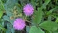 Beautiful insects on a beautiful tiny flower.jpg 4,208 × 2,368; 2.89 MB
-
 Bhaba Ranjan Reang.jpg 1,411 × 2,000; 688 KB
-
 Bhoot jolokia.jpg 2,592 × 4,608; 1.93 MB
-
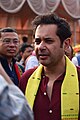
 Bijoy Kumar Hrangkhawl in 2024.jpg 2,617 × 3,092; 2.07 MB
-
 Buff-chested Babbler.jpg 1,540 × 954; 441 KB
-
 Burmese Python (Python bivittatus).jpg 4,290 × 2,856; 2.3 MB
-
 Common name- Himalayan Red Lacewing.jpg 705 × 400; 95 KB
-
 Common name- Root Holoparasite.jpg 739 × 470; 81 KB
-
-

-
 Feral Horse.jpg 1,100 × 500; 476 KB
-
 Kiwi of Upper Siang.jpg 4,000 × 6,000; 3.74 MB
-
 Kriti Devi Debbarma Tripura Lok Sabha MP.jpg 4,995 × 4,160; 8.63 MB
-
 Kriti Singh Debbarma 2024.jpg 4,000 × 5,573; 14.35 MB
-
 Linguistic map of Northeast India English.png 716 × 744; 123 KB
-
 Linguistic map of Northeast India Native.png 716 × 744; 93 KB
-
 Maa Kali temple.jpg 2,592 × 4,608; 3.27 MB
-
 Mayudia pass, Arunachal.jpg 4,000 × 2,250; 4.76 MB
-
 Miju Mishmi Girl.jpg 6,016 × 4,016; 13.52 MB
-
 Mud Pot for water storage.jpg 2,592 × 4,608; 2.77 MB
-
 N.C. Debbarma (cropped).jpg 452 × 678; 207 KB
-
 N.C. Debbarma.jpg 525 × 795; 237 KB
-
 Nanda Kumar Debbarma.jpg 1,080 × 1,093; 393 KB
-
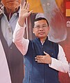
 Narendra Debbarma 2024.jpg 4,000 × 4,299; 3.62 MB
-
 Natural Pool Near Living Roots Bridge.jpg 4,928 × 3,264; 7.4 MB
-
 Orange from Assam.jpg 2,592 × 4,608; 3.17 MB
-
 Orchid from Assam.jpg 2,592 × 4,608; 1.91 MB
-
 OSM North East India.jpg 1,200 × 1,600; 1.04 MB
-
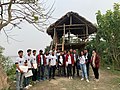 Participants group photo of OSM North East India community.jpg 1,600 × 1,200; 1.45 MB
-
 Paul Dangshu 2023.jpg 2,656 × 3,984; 8.39 MB
-
 Pinon Hadi.jpg 720 × 1,126; 124 KB
-
 Pradyot Bikram Manikya Debbarma.jpg 4,000 × 6,000; 12.85 MB
-
 Purna Chandra Jamatia.jpg 1,651 × 1,819; 1.27 MB
-
 Radish from Assam.jpg 2,592 × 4,608; 2.8 MB
-
 Rajesh Tripura.jpg 3,183 × 4,144; 7.47 MB
-
 Rajeshwar Debbarma in 2024.jpg 2,771 × 3,291; 1.89 MB
-
 Sangai Deer Replica in Manipur.jpg 6,000 × 4,000; 9.04 MB
-
 Sefali Debbarma in 2022.jpg 1,800 × 4,000; 2.76 MB
-
 Sukhendu Debbarma.jpg 720 × 695; 284 KB
-
 Trimeresurus mayaae.png 991 × 1,245; 1.48 MB
-
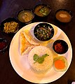 Tripuri Thali served in Agartala restaurant.jpg 3,024 × 3,383; 3.44 MB
-
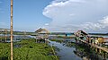 Urpad beel.jpg 4,608 × 2,592; 3.28 MB
-
 Ward's Trogon Male.jpg 3,042 × 1,903; 2.02 MB
-
 Ward's Trogon, Eastern Himalayas.jpg 3,042 × 1,903; 2.59 MB
-
 Wire Bridge in Nongriat.jpg 2,448 × 3,264; 1.61 MB
-
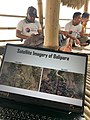
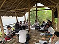 Workshop on OpenStreetMap.jpg 1,600 × 1,200; 1.51 MB


.jpg)


.jpg)


