Atlas of Asia

Uit Wikimedia Commons
Naar navigatie springen Naar zoeken springen
Wikimedia Commons Atlas of the World

De Wikimedia Wereldatlas is een becommentarieerde verzameling van kaarten beschikbaar in Wikimedia Commons. De toelichting in de atlaspagina's is in het Engels. Daaraan is bij Nederlandstalige entiteiten - Nederland, België
Overleg • Update the atlas • Index of the Atlas • Atlas in categories • Other atlases on line
The introductions of the country, dependency and region entries are in the native languages and in English. The other introductions are in English.


Atlas of Asia
Asia
English Asia
Asia is the largest and most populous continent or region, depending on the definition. It covers 8.6% of the Earth's total surface area, or 29.4% of its land area, and it contains more than 60% of the world's human population. Asia is traditionally defined as part of the landmass of Africa-Eurasia – with the western portion of the latter occupied by ► Europe – lying east of the Suez Canal, east of the Ural Mountains, and south of the Caucasus Mountains and the Caspian and Black Seas.
中文 亚洲

亚细亚洲(英語:Asia;字源古希腊文:Ασία ),简称亚洲,大部分土地位于北半球,是七大洲中面积最大,人口最多的一个洲。大陆东至白令海峡的杰日尼奥夫角(西经169度40分,北纬60度5分),南至努沙登加拉群岛(东经103度30分,南纬11度7分),西至巴巴角(东经26度3分,北纬39度27分),北至切柳斯金角(东经104度18分,北纬77度43分),最高峰为珠穆朗瑪峰。跨越经纬度十分广,东西时差达11小时。西部与欧洲相连,形成地球上最大的陆块欧亚大陆。

हिन्दी जंबुद्वीप

जम्बुद्वीप (जंबुमहाद्वीप, या एशिया) विश्व का क्षेत्रफल और जनसंख्या दोनो के हिसाब से सबसे बड़ा महाद्वीप है । भौगोलिक रूप से ये यूरेशिया महाखंड का पूर्वी हिस्सा है । यानि कि यूरोप और जंबूद्वीप में फ़र्क सिर्फ एतिहासिक और सांस्कृतिक है ।

Bahasa Indonesia Asia

Benua Asia merupakan wilayah yang mencakup daratan luas Afrika-Eurasia tanpa Eropa dan Afrika. Batas antara Asia dan Eropa sangat kabur, yakni berasa di wilayah Dardanella, Laut Marmara, selat Bosforus, Laut Hitam, pegunungan Kaukasus, Laut Kaspia, Sungai Ural (atau Sungai Emba), dan Pegunungan Ural hingga Novaya Zemlya, sedangkan dengan Afrika, Asia bertemu di sekitar Terusan Suez. Sekitar 60% populasi dunia tinggal di Asia. Lihat pula Eurasia.

العربية آسيا

تعتبر آسيا أكبر القارات من حيث المساحة والسكان، فتشمل 30% من اليابسة، ويعيش عليها تقريب ثلاثة أخماس سكان العالم، وتقع تقريبا في نصف الكرة الشمالي . يحدها شمالا المحيط القطبي الشمالي وبشرقه ممر بيرنج الجليدي. وفي الجنوب المحيط الهندي وبالغرب البحرين الأحمر والأبيض المتوسط. وشمال غرب تقع حدودها مع أوروبا. آسيا متصلة مع اوروبا بحيث انه يمكن اعتبراهما قارة واحدة ولكنهما تعتبران قارتين لاسباب تاريخية، وتعتبر جبال الاورال ونهر الاورال الفاصل بينهما. ترتبط مع افريقيا بشبه جزيرة سيناء وتعتبر قناة السويس الخط الفاصل بينهما. يقطن آسيا اكبر عدد من السكان مقارنة بالقارات الأخرى وفيها اكبر تجمعيين سكانيين في دول وهما الصين (1.3 بليون نسمة) والهند (1.1 بليون نسمة)، كما أن بها أكبر دول العالم وأصغرها مساحة روسيا و هي اكبر دولة عالمية من حيث المساحة بحث تغطي مساحة قدرها 17 مليون كيلومتر مريع، وهنا أصغر الدول مثل البحرين، المالديف، وسنغافورة مساحة كل منها أقل من 780 كيلومتر مربع. أكثر من خمسي بلاد آسيا بها سكان أقل من 6 مليون نسمة. قامت بها أكبر عدد من الحضارات القديمة كحضارات الهند وبابل وسومر وآشور والفرس والصين. وحضارة الفنيقيين والحيثيين والحضارة الإسلامية.

日本語 アジア

アジア(亜細亜、'Asia)は、古代においては、現在のトルコ西部の地域にあたる古代ローマの属州アジアとその一帯を指す。アッシリア語で東を意味する「アス」に語源をもつ。また、略称は亜である。現在ではユーラシア大陸のヨーロッパ以外の地域(ユーラシア大陸の中・東部、アジア大陸)およびその周辺の島嶼・海域を含む地域の総称で、六大州の一つ。ユーラシア大陸の面積の約80%をアジアが占める。

한국어 아시아

아시아는 정의에 따라 가장 크고 가장 인구가 많은 대륙이나 지역입니다. 지구 전체 표면적의 8.6%, 즉 국토 면적의 29.4%를 차지하고 있으며, 전 세계 인구의 60% 이상을 차지하고 있습니다. 아시아는 전통적으로 아프리카-유라시아 영토의 일부로 간주되며, 유럽이 차지하는 아시아의 서쪽 부분은 수에즈 운하와 우랄 산맥의 동쪽, 코카서스 산맥과 카스피해 그리고 흑해의 남쪽에 위치합니다.

Population 3,902,404,193 inhabitants
Area 43,810,582 km²
Major language(s) Chinese, Hindi, Indonesian, Arabic, Bengali, Japanese, etc.
Major religion(s) Hinduism, Buddhism, Islam
More information Asia, Geography of Asia, History of Asia and Politics of Asia
More images Asia - Asia (Category).

General maps

Map of Asia
Political map with 1st level divisions as of 1998 in SVG format
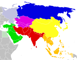
Regions of Asia:
Central Asia
East Asia

Maps of the Middle East

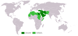
Location of the Middle East
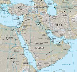
Middle East
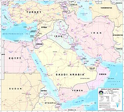
Middle East

Current events

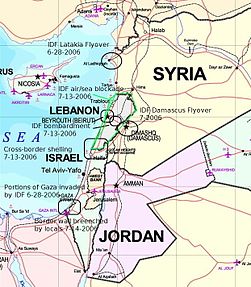
The Middle East conflict 2006
Israel and members of the Arab League (Comoros is not shown)

History maps

This section holds a short summary of the history of the area of present-day Asia, illustrated with maps, including historical maps of former countries and empires that included present-day Asia.

Indo-Iranians
Eurasia in 1200
The Mongol Empire 1206-1294
Asia in 1345.
Second World War 1937-1942
Second World War 1942-1945

Central Asia

Uyghur Khaganate

Middle East

Orient 2000 BC
Map of the Ancient Near East during the Amarna period, showing the great powers of the period: Egypt (green), Hatti (yellow), the Kassite kingdom of Babylon (purple), Assyria (grey), and Mittani (red). Lighter areas show direct control, darker areas represent spheres of influence. The extent of the Achaean/Mycenaean civilization is shown in orange.
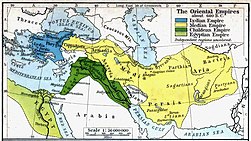
Oriental empires 600 BC
Levant 800 BC
[[|border|251x400px]] Syro-Ephraimite War, 736-732 BC
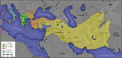
Seleucid Empire, 323-360 BC
Crusader states c. 1100 AD

Old maps

This section holds copies of original general maps more than 70 years old.

Ptolemy map of Asia
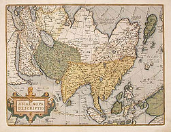
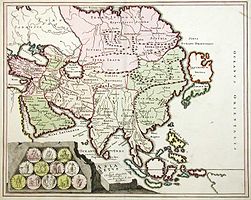
Asia in 1595 (Ortelius)
Asia in 1607 (Hondius)
Map depiction of 1719 of Asia
Asia in 1689 (Van Keulen)
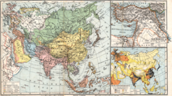
Asia in 1892
Asia in 1904
Asia in 1905
Asia in 1914
[[|border|251x400px]] Asia in 1932

Maps of international organizations

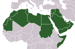
Arab League
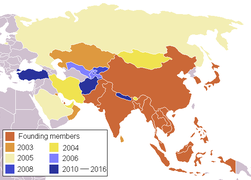
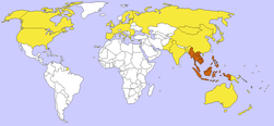
Asian Co-operation Dialogue
Association of Southeast Asian Nations
ASEAN Regional Forum
South Asian Association for Regional Cooperation
Cooperation Council for the Arab States of the Gulf
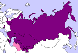
Shanghai Cooperation Organization
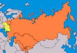
Commonwealth of Independent States
 
member state
 
associate member
Central Asian Cooperation Organization
Economic Cooperation Organization
Eurasian Economic Community
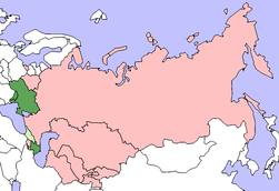
GUAM Organization for Democracy and Economic Development
Organization for Security and Co-operation in Europe
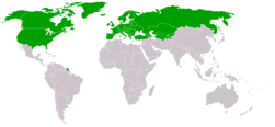
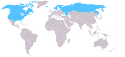
Arctic Council
Asia-Pacific Economic Cooperation
Arab League
Arab League
Organisation of Islamic Cooperation. Full members in green.

Language maps

Sino-Tibetan languages
Turkic states

Satellite maps

Satellite map of Asia

Notes and references

General remarks:

  • The WIKIMEDIA COMMONS Atlas of the World is an organized and commented collection of geographical, political and historical maps available at Wikimedia Commons. The main page is therefore the portal to maps and cartography on Wikimedia. That page contains links to entries by country, continent and by topic as well as general notes and references.
  • Every entry has an introduction section in English. If other languages are native and/or official in an entity, introductions in other languages are added in separate sections. The text of the introduction(s) is based on the content of the Wikipedia encyclopedia. For sources of the introduction see therefore the Wikipedia entries linked to. The same goes for the texts in the history sections.
  • Historical maps are included in the continent, country and dependency entries.
  • The status of various entities is disputed. See the content for the entities concerned.
  • The maps of former countries that are more or less continued by a present-day country or had a territory included in only one or two countries are included in the atlas of the present-day country. For example the Ottoman Empire can be found in the Atlas of Turkey.

Entries available in the atlas

General pages
World
Continents and oceans
Themes
Historical eras
States with wide recognition
States with limited recognition
Dependencies and other overseas territories
Country subdivisions
Belgium
China (mainland)
India
Pakistan
Spain
United Kingdom
United States
Russia
Other
Disputed subnational territories
Other regions
Cities
Former sovereign states
Former dependencies and overseas territories
Former disputed territories