Atlas of Tibet
Jump to navigation
Jump to search
- For the maps of the cultural region, see maps of Tibet

|
Wikimedia Commons Atlas of the World The Wikimedia Atlas of the World is an organized and commented collection of geographical, political and historical maps available at Wikimedia Commons. Discussion • Update the atlas • Index of the Atlas • Atlas in categories • Other atlases on line |
The introductions of the country, dependency and region entries are in the native languages and in English. The other introductions are in English.
|
| ||||||||||||||||||||||||||||||||||||
.svg)

General maps

|
Topographic map of Tibet Autonomous Region |

|
Ethnolinguistic map of Tibet, 1967 (See entire map, which includes a key) |
Maps of divisions
This section holds maps of the administrative divisions.
-
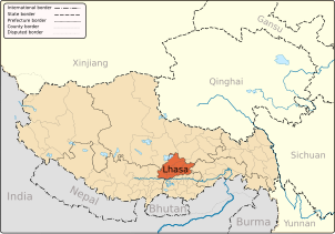 Lhasa City, capital of the Region
 -
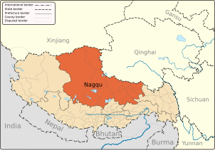 Nagqu Prefecture
 -
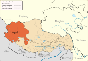 Ngari Prefecture
 -
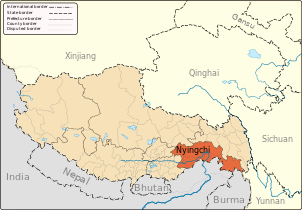 Nyinchi Prefecture
 -
 Qamdo Prefecture
 -
 Shannan Prefecture
 -
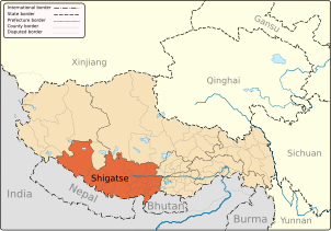 Shigatse Prefecture


History maps
This section holds a short summary of the history of the area of present-day Tibet, illustrated with maps, including historical maps of former countries and empires that included present-day Tibet.

|
Tibetan Empire at its greatest extent between the 780s and the 790s |

|
Territorial evolution of the Mongol Empire (1206–1294) |

|
Tibet under Yuan rule (1244–1354) |

|
Tibet during the Ming dynasty (1415) |

|
Tibet under Qing rule (1644–1912) |

|
Tibet in 1945 |
Old maps
This section holds copies of original general maps more than 70 years old.

|
« La Chine, la Tartarie Chinoise et le Thibet » in 1734 from Jean-Baptiste Bourguignon d'Anville |

|
Early 19th-century en:map of Lhasa, as composed by en:Nikita Yakovlevich Bichurin |

|
Map of Lhasa (1932) |
Satellite maps

|
Satellite map of Tibet |
Notes and references
|
General remarks:
|