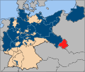
Atlas of states of Germany
- Also see: Atlas of Germany.

|
Wikimedia Commons Atlas of the World The Wikimedia Atlas of the World is an organized and commented collection of geographical, political and historical maps available at Wikimedia Commons. Discussion • Update the atlas • Index of the Atlas • Atlas in categories • Other atlases on line |
|
| ||||||||||||||||||||||||||||||||||||||||||||
General maps
|
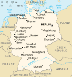
Map of Germany Karte Deutschlands |

|
Map of Germany in German Karte Deutschlands |
-
Map of Germany
Karte Deutschlands
Maps of divisions
This section holds maps of the administrative divisions.

|

|
| Federal States of Germany Die Bundesländer |
Politische Gliederung Political structure |
Locator maps of the actual German länder
-
Bayern (2)
-
Berlin (3)
-
Brandenburg (4)
-
Bremen (5)
-
Hamburg (6)
-
Hessen (7)
-
Niedersachsen (9)
-
Nordrhein-Westfalen (10)
-
Rheinland-Pfalz (11)
-
Saarland (12)
-
Sachsen (13)
-
Sachsen-Anhalt (14)
-
Schleswig-Holstein (15)
-
Thüringen (16)
Topographic maps of single länder
-
Baden-Württemberg
-
Hessen
-
Mecklenburg-Vorpommern
-
Nordrhein-Westfalen
-
Sachsen
-
Schleswig-Holstein
Districts
Besides the following maps of all Germany, there are overviews of the districts of each land

|
 |
| Landkreise and free cities (yellow) | Landkreise with electoral districts |
Former German fractional states
History of former German states
Prussia

|
1618-1701: Brandenburg-Prussia (Brandenburg-Preussen) - monarchy most of the time partly inside the Holy Roman Empire c.q. successor states |
| 1701-1871: Kingdom of Prussia (Königreich Preussen) - monarchy most of the time partly inside the Holy Roman Empire c.q. successor states |
|
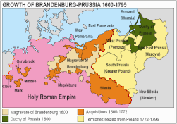
Growth of Prussia 1600-1795 |

|
Growth of Prussia 1807-1871 |

|
The ten provinces of the Kingdom of Prussia, at the time of the formation of the German Confederation (1815) |

|
Prussia at the time of the formation of the German Empire (1871) |

|
Prussia 1871-1919 |

|
The Free State of Prussia at the time of the Weimar Republic (1919) |
|
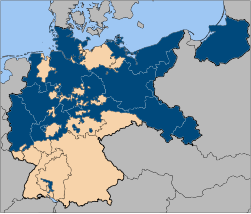
The provincial divisions of the Free State of Prussia (early 1920) |

|
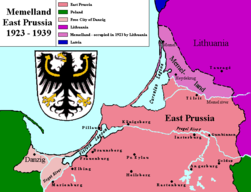
East Prussia 1923-1939 |
|
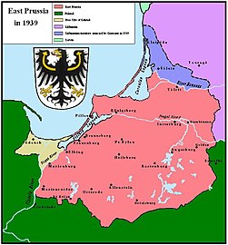
East Prussia 1939 |
|
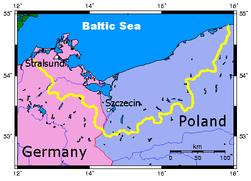
Pomerania |
|
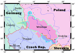
Silesia |
|
Memel Territory (now in Lithuania) |
Baden
| 1867-1871: Grand Duchy of Baden (Grossherzogtum Baden) - independent monarchy |

|
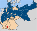
After the Austro-Prussian war, Baden remained outside the North-German Confederation. In a way it was independent between 1867 and 1871, when it joined the German Empire. |
Bavaria
| 1867-1871: Kingdom of Bavaria (Köngigreich Bayern) - independent monarchy After the Austro-Prussian war, Bavaria remained outside the North-German Confederation. In a way it was independent between 1867 and 1871, when it joined the German Empire. |
Hesse

|
1867-1871: Grand Duchy of Hesse and by Rhine (Grossherzogtum Hessen und zu Rhein) - independent monarchy After the Austro-Prussian war, the south part of Hesse remained outside the North-German Confederation. In a way it was independent between 1867 and 1871, when it joined the German Empire. |
Württemberg
| 1867-1871: Kingdom of Württemberg (Königreich Württemberg) - independent monarchy After the Austro-Prussian war, Württemberg remained outside the North-German Confederation. In a way it was independent between 1867 and 1871, when it joined the German Empire. |
States inside the German Empire

|
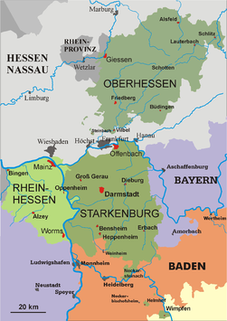
Hesse-Darmstadt |

|
Anhalt |
|
Hesse-Darmstadt 1930 |
|
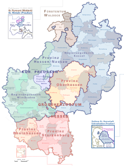
Map of the Hessian countries around 1900 |

|
Saxony Duchies in Thuringia |

|
Saxony 1930 |

|
Free City of Lübeck |
|
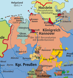
Kingdom of Hannover in the German Confederation |
Saar
| 1920-1935: Territory of the Saar Basin (Territoire du Bassin de la Sarre/Saarbeckengebiet) - territory under French League of Nations mandate |
| 1947-1956: Saar (Saar) - French protectorate |
Lander at the time of the proclamation the two German States in 1949
German Democratic Republic (DDR)
German Democratic Republic
| 1949-1990: German Democratic Republic (Deutsche Demokratische Republik) - independent people's republic, satellite state of the USSR |

|
In 1949 the German Democratic Republic was proclaimed in the Soviet zone of Germany. |

|
Districts of German Democratic Republic |
Old maps of all Germany
Old maps
This section holds copies of original general maps more than 70 years old.

|
1450 |

|
Herman Moll New Map of Germany |

|
Historical map of the German Empire |

|
Prussia (political map before 1905) |

|
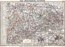
Kingdom of Saxony 1895 |
|
Kingdom of Saxony 1905 |

|
Baden and Rhenish Bavaria 1905 |

|
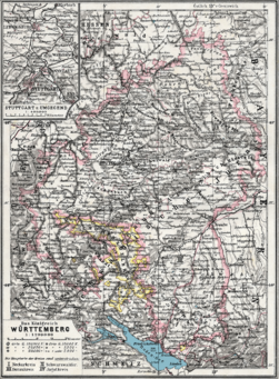
Württemberg and Hohenzollern |
|
Kingdom of Württemberg 1905 |

|
Historical map of Alsace-Lorraine (Reichsland Elsaß-Lothringen) 1905 |

|
Alsace-Lorraine 1905, area of the territory highlighted |

|
High-resolution map (7,473 × 7,773) of Alsace-Lorraine as part of the German Empire, 1887 |

|
Historical map of Hannover, Oldenburg, Braunschweig 1905 |
|
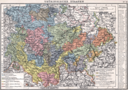
Historical map of the Thuringian states 1905 |

|
Historical map of Mecklenburg 1905 |

|
Historical map of Brandenburg 1905 |
|
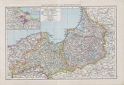
Historical map of East- and Westprussia (Prussian Provinces) 1890 |

|
Historical map of Hesse-Nassau (Prussian Province) 1905 |

|
Historical map of Province of Pomerania 1905 |

|
Historical map of Posen 1905 |

|
Historical map of Rhenish Prussia 1905 |

|
Historical map of Saxony (Prussian Province) 1905 |
|
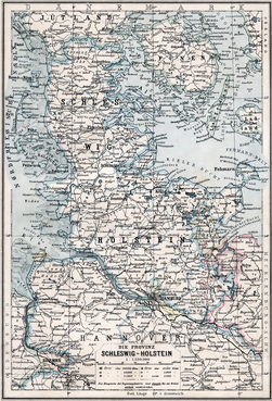
Historical map of Schleswig-Holstein as Prussian Province 1905 |

|
Historical map of Silesia as Prussian Province 1905 |

|
Historical map of Westphalia as Prussian Province 1905 |
Satellite maps
Notes and references
|
General remarks:
|


