Shqipëria është një vend mesdhetar i cili shtrihet në juglindje të Evropës, në perëndim të Gadishullit Ballkanik, me koordinatat gjeografike: 41°19'39" gjerësi veriore dhe 19°49'8" gjatësi lindore. Shqipëria ka një sipërfaqe prej 28.748 km².
The Republic of Albania is a Balkan country in Southeastern Europe. It borders ► Montenegro to the north, ► Kosovo to the northeast, the ► Republic of Macedonia in the east, and ► Greece in the south. It has a coast on the Adriatic Sea to the west and a coast on the Ionian Sea to the southwest.
This section holds a short summary of the history of the area of present-day Albania, illustrated with maps, including historical maps of former countries and empires that included present-day Albania.
Ethnic territory of the Illyrians and Illyrian tribes (8th-3rd century BC)
Illyrians in the Balkans and Italy in 550 BC
Illyrians in the Balkans and Italy in 550 BC
Map of Dionysius of Syracuse's military attempts to place Alcetas in the throne of the Molossians (385 BC) - army of Illyrian / Dardanian king Bardyllis also participated in this military intervention
Illyrian tribes in the Balkans and Italy prior to Roman conquest
Illyrians, Illyria Barbara, Illyria Graeca, Illyrians Proper and Environs
Approximate extent of the Illyrian territories prior to Roman conquest
Illyrian tribes in the Balkans and Italy prior to Roman conquest
Illyrian tribes in the Balkans and Italy prior to Roman conquest
Illyrian tribes in the Balkans
Illyrians in the Balkans prior to Roman conquest
(svg) Illyrians proper prior to Roman conquest
Illyrian tribes and cities in the southern Balkans (4th century BC)
(svg) Illyrian tribes and cities in the southern Balkans (4th century BC)
Territory of emperor Galerius during the Tetrarchy
Roman prefecture of Illyricum, 4th century
Roman prefecture of Illyricum, 4th century
Roman prefecture of Illyricum, 4th century
Roman Empire divided 395, showing the dioceses and praetorian prefectures of Gaul, Italy, Illyricum and Oriens (east), roughly analogous to the four Tetrarch zones of influence after Diocletian's reforms.
Roman dioceses of Macedonia and Dacia
The division of the Empire after the death of Theodosius I, ca.395 AD superimposed on modern borders.
Ethnic Albanians in the Balkans, 6th-8th century (according to the historical atlas for schools, published in Belgrade in 1970, representing a view of Yugoslav historians from that time)
Ethnic Albanians in the Balkans, 7th-8th century
The Byzantine Empire at the accession of Basil I, c. 867
Devol province of the Bulgarian Empire (9th-10th century) and Great Devol province (11th-12th century)
Albanian vilayet, proposed by the League of Prizren in 1878
Albanian vilayet, proposed by the League of Prizren in 1878
Albanian vilayet, proposed by the League of Prizren in 1878
Ottoman provinces in the Balkans in 1905
Independent Albania in 1912-1913; territories under Albanian de facto control
Independent Albania in 1912-1913; territories recognized as parts of Albanian state
Independent Albania in 1912-1913; territories recognized as parts of Albanian state
Serbian occupation of Albania in 1912
Serbian occupation of Albania in 1913
Serbian occupation of Albania in 1913
Albania in 1913
Albania in 1917
North Albania in 1918
Albania in 1920
Greek counteroffensive in 1940
Greek counteroffensive in 1940
Greek occupation of south Albania, November 1940 - March 1941
Greater Albania in 1941
Greater Albania in 1941
Greater Albania in 1941-1944
Greater Albania in 1942
Greater Albania in 1942
Balkanic federation whose creation was proposed after World War II
Albania, 1946-1991
Kosovo refugees in Albania in 1999
Map of Albania and bordering countries from 2003 to 2006
Ethnic, linguistic and religion maps
Ethnic map (1861)
Ethnic map (1877)
Ethnographic map of the Epirus region, 1878. Greek point of view
Ethnic map (1880)
Peoples at the Balkan Peninsula, Andrees Allgemeiner Handatlas, 1st Edition, Leipzig (Germany) 1881
Ethnic map of the Southwestern Balkan Peninsula (1890)
Ethnic map (1898)
Ethnic map (1898)
Vlachs in Albania at the beginning of the XX century
Ethnic map (1911)
Ethnic map of the Balkans (1923)
Ethnic composition of Albania, municipality data of 1989 census
Distribution of Albanians outside Albania
Albanians in Europe
Number of Albanians by state
The distribution of Haplogroup E-V13 in Europe
Traditional linguistic and religious communities in Albania
thumb
Gora Region between Kosovo and Albania
Vlachs in Albania
Albanian dialects
Albanian dialects
Orthodox Dioceses in Albania
Roman Catholic Dioceses in Albania
Other maps
The Swine flu spread in Albania, as of July, 25th, 2009
Politics
Map of proposed Greater Albania
Map of proposed Greater Albania
Presence of Albanians in proposed Greater Albania
Old maps
North Albania in 1918
Satellite maps
Satellite map
Districts of Albania
Berat
Bulqize
Delvine
Devoll
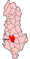
Diber
Durres
Elbasan
Fier
Gjirokaster
Gramsh
Has
Kavaje
Kolonie
Korce
Kruje
Kocove
Kukes
Kurbin
Lezhe
Librazhd
Malesi e Madhe
Mallakaster
Mat
Mirdite
Peqin
Permet
Pogradec
Puke
Sarande
Shkoder
Skrapar
Tepelene
Tirane
Tropoje
Vlore
Notes and references
General remarks:
The WIKIMEDIA COMMONS Atlas of the World is an organized and commented collection of geographical, political and historical maps available at Wikimedia Commons. The main page is therefore the portal to maps and cartography on Wikimedia. That page contains links to entries by country, continent and by topic as well as general notes and references.
Every entry has an introduction section in English. If other languages are native and/or official in an entity, introductions in other languages are added in separate sections. The text of the introduction(s) is based on the content of the Wikipedia encyclopedia. For sources of the introduction see therefore the Wikipedia entries linked to. The same goes for the texts in the history sections.
Historical maps are included in the continent, country and dependency entries.
The status of various entities is disputed. See the content for the entities concerned.
The maps of former countries that are more or less continued by a present-day country or had a territory included in only one or two countries are included in the atlas of the present-day country. For example the Ottoman Empire can be found in the Atlas of Turkey.


.svg)
.png)
.jpg)


.png)
.svg)
.svg)
.png)
.svg)
.svg)


.svg)
.svg)
.png)

.svg)
_(English).svg)
.svg)
_(English).svg)
.svg)
.svg)
.svg)
.svg)

.png)


.svg)

.svg)


.png)

.png)


.svg)


.PNG)


.PNG)


.svg)


-fr.png)


.jpg)


.png)


.jpg)


 Berat
Berat Bulqize
 Delvine
 Devoll
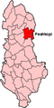 Diber
Diber Durres
 Elbasan
 Fier
Fier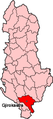 Gjirokaster
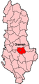 Gramsh
 Has
Has Kavaje
 Kolonie
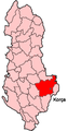 Korce
Korce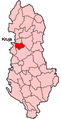 Kruje
Kruje Kocove
 Kukes
Kukes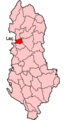 Kurbin
 Lezhe
Lezhe Librazhd
 Malesi e Madhe
 Mallakaster
 Mat
Mat Mirdite
 Peqin
Peqin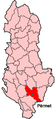 Permet
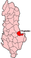 Pogradec
 Puke
Puke Sarande
 Shkoder
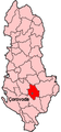 Skrapar
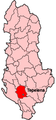 Tepelene
 Tirane
 Tropoje
 Vlore
Vlore


