Cộng hòa Xã hội Chủ nghĩa Việt Nam, là một quốc gia nằm phía đông của bán đảo Đông Dương, thuộc khu vực Đông Nam Á. Lãnh thổ Việt Nam tiếp giáp với nước Trung Quốc ở phía bắc, nước Lào và nước Campuchia ở phía tây, vịnh Thái Lan ở phía tây nam và biển Đông ở phía đông và phía nam với hơn 4.000 hòn đảo, bãi đá ngầm lớn nhỏ, gần và xa bờ, có vùng nội thuỷ, lãnh hải, vùng đặc quyền kinh tế và thềm lục địa được Chính phủ Việt Nam xác định gần gấp ba lần diện tích đất liền (khoảng trên 1 triệu km2).
The Socialist Republic of Vietnam is a nation in Southeast Asia. It borders the ► People's Republic of China with ► Guangxi to the north, ► Laos to the northwest and ► Cambodia to the southwest. To the country's east lies the East Vietnam Sea which China calls South China Sea, where there are over 4000 islands located including Vietnam's claims on the ► Paracel Islands and the ► Spratly Islands, that border ► Indonesia, ► Malaysia, ► Brunei and the ► Philippines. With a population of approximately 88 million, Vietnam is one of the most densely populated nations in Southeast Asia. Vietnam had its continental shelf estimated to be around triple size of its current land area.
Other languages
Français: Le Viêt Nam (République Socialiste du Viêt Nam) est un pays d'Asie du Sud-Est. Il se situe à l'extrême est de la péninsule indochinoise. Le pays occupe une superficie de 331 690 km² pour environ 85 millions d'habitants. Il est entouré de la Chine au nord ; du Laos et du Cambodge à l'ouest ; et de la mer de l'est, à l'est et au sud.
Deutsch: Vietnam (vietnamesisch Việt Nam, Bedeutung: Viet des Südens, amtlich Sozialistische Republik Vietnam, vietn. Cộng hòa Xã hội chủ nghĩa Việt Nam, Chữ Nôm 共和社會主義越南) ist ein langgestreckter Küstenstaat in Südostasien. Er grenzt an die VR China, Laos, Kambodscha, den Golf von Thailand und das Südchinesische Meer.
Short name
Vietnam
Official name
Socialist Republic of Vietnam
Status
Independent country since 1945, recognized 1954, united since 1976
This section holds a short summary of the history of the area of present-day Vietnam, illustrated with maps, including historical maps of former countries and empires that included present-day Vietnam.
Ancient period
Âu Việt (Xi Ou) and Lạc Việt (Luo Yue) (210 BC).
Map of Nanyue Kingdom at its greatest territorial extent.
Circuits and cities of Annan, Ngô Dynasty, as of 940.
Period of the 12 Warlords
Đại Việt during Lý Dynasty c. 1085.
Đại Việt c. 1111.
Asia in 1290.
Dai Viet c. 1428.
Đại Việt c. 1480.
Vietnam circa 1540
Vietnam circa 1570 showing the Mac in control of the land north of the Red river, and the Nguyen-Trinh alliance in control of the southern part of Vietnam.
Vietnam around 1650.
Đại Việt (Annam) during the Later Lê Dynasty in 1760.
Vietnam around 1788.
Vietnam around 1834.
Vietnam around 1838.
Vietnam around 1857.
Southward expansion (Nam Tien) of the Dai Viet Empire.
The drawing shows the French disposition at the Battle of Dien Bien Phu, as of March 1954. The French took up positions on a series of fortified hills (shown in green). The southermost, Isabelle, was dangerously isolated. The Viet Minh positioned their 5 divisions (the 304th, 308th, 312th, 316th, and 351st) in the surrounding areas to the north and east. From these areas, the Vietminh had a clear line of sight on the French fortifications and were able to accurately rain down artillery on the French positions.
Animated map of the history of railway construction in Vietnam, 1881–1966.
Map of the Sino–Vietnamese War (Third Indochina War), 1979.
Old maps
This section holds copies of original general maps more than 70 years old.
Early Western Map of Tonkin (1651).
Notes and references
General remarks:
The WIKIMEDIA COMMONS Atlas of the World is an organized and commented collection of geographical, political and historical maps available at Wikimedia Commons. The main page is therefore the portal to maps and cartography on Wikimedia. That page contains links to entries by country, continent and by topic as well as general notes and references.
Every entry has an introduction section in English. If other languages are native and/or official in an entity, introductions in other languages are added in separate sections. The text of the introduction(s) is based on the content of the Wikipedia encyclopedia. For sources of the introduction see therefore the Wikipedia entries linked to. The same goes for the texts in the history sections.
Historical maps are included in the continent, country and dependency entries.
The status of various entities is disputed. See the content for the entities concerned.
The maps of former countries that are more or less continued by a present-day country or had a territory included in only one or two countries are included in the atlas of the present-day country. For example the Ottoman Empire can be found in the Atlas of Turkey.


 An Giang
 Bac Giang
 Bac Kan
 Bac Lieu
 Bac Ninh
 Ba Ria-Vung Tau
 Ben Tre
 Binh Dinh
 Binh Duong
 Binh Phuoc
 Binh Thuan
 Ca Mau
 Can Tho
 Cao Bang
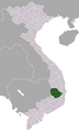 Dak Lak
 Dak Nong
 Da Nang
 Dien Bien
 Dong Nai
 Dong Thap
 Gia Lai
 Ha Giang
 Ha Nam
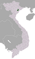 Hai Duong
 Hai Phong
 Hanoi
Hanoi Hau Giang
 Ha Tay
 Ha Tinh
 Hoa Binh
 Ho Chi Minh City
 Hung Yen
 Khanh Hoa
 Kien Giang
 Kon Tum
 Lai Chau
 Lao Cai
 Lam Dong
 Lang Son
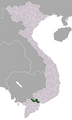 Long An
 Nam Dinh
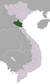 Nghe An
 Ninh Binh
 Ninh Thuan
 Phu Tho
 Phu Yen
 Quang Binh
 Quang Nam
 Quang Ngai
 Quang Ninh
 Quang Tri
 Soc Trang
 Son La
 Tay Ninh
 Thai Binh
 Thai Nguyen
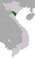 Thanh Hoa
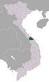 Thua Thien-Hue
 Tien Giang
 Tra Vinh
 Tuyen Quang
 Vinh Long
 Vinh Phuc
 Yen Bai


.png)


.png)


.png)


.png)
.png)
.svg)

.gif)


.png)


