New Zealand is a country in the southwestern Pacific Ocean comprising two large islands (the North Island and the South Island) and numerous smaller islands, most notably Stewart Island and the Chatham Islands. In Māori, New Zealand is also known as Aotearoa, which is usually translated into English as the Land of the Long White Cloud. The Realm of New Zealand also includes the ► Cook Islands and ► Niue, which are self-governing, but in free association; ► Tokelau; and the Ross Dependency (New Zealand's territorial claim in ► Antarctica). New Zealand is notable for its geographic isolation, being separated from ► Australia to the northwest by the Tasman Sea, some 2000 kilometres (1250 miles) across. Its closest neighbours to the north are ► New Caledonia, ► Fiji, ► Norfolk Island and ► Tonga. Associated states are the ► Cook Islands and ► Niue, the overseas territory is ► Tokelau.
He whenua, he kāhui moutere a Aotearoa i Te Moana-nui-a-Kiwa. Ko ngā moutere matua ko Te Ika-a-Māui ki te raki, ko Te Wai-pounamu, arā Te Waka-a-Māui ki waenganui, me Rakiura ki te tonga. Ko Aotearoa te ingoa Māori o nāianei mō te motu. Engari i tērā atu rautau, ko 'Aotearoa' tētahi o ngā ingoa o Te Ika-a-Māui kē. Ko ngā whenua o roto o te Kīngitanga o Aotearoa ko ngā whenua moutere nei ko ngā Kuki Airani, ko Niue; he kāwanatanga ake o aua whenua, engari ka mau tonu he pānga wātea ki Aotearoa; ko Tokelau, me ngā wāhi kerēmetia rā o Antarctica ki ngā tahatai o te Moana o Ross. Ko Aotearoa he rōpū moutere e tū mokemoke ana, e roa rawa te tawhiti ki whenua kē. E 2000 kiromita te tawhiti ki Ahitireiria, ko Te Tai-o-Rehua te moana wehe i aua whenua e rua. Ko ngā whenua e tū tata ana ki te raki ko Niu Karatonia, ko Whiti, ko Te Moutere Nōpoke, ko Tonga.
The hemisphere centred on Wellington, New Zealand's capital.
Labelled map of the Realm of New Zealand
Realm of New Zealand (detail)
New Zealand's southern offshore islands
Map of regions (coloured) with territorial authorities delineated by black lines
North Island
South Island
History maps
This section holds a short summary of the history of the area of present-day New Zealand, illustrated with maps, including historical maps of former countries and empires that included present-day New Zealand.
Pre-colonial era
The Maori settle New Zealand in the thirteenth century. In 1642 the Dutch explorer Abel Tasman discovers the islands. The Dutch name the islands Nova Zeelandia.
A year later New Zealand becomes a separate British colony. Some Maori do not accept British rule and resist British control in various wars in 1843-1848 and 1860-1872.[1]
This is an image of a chart of New Zealand made by Lieutenant (later Captain Sir) James Cook during his 1770 voyage of exploration in the Pacific in command of HM Bark Endeavour.
The WIKIMEDIA COMMONS Atlas of the World is an organized and commented collection of geographical, political and historical maps available at Wikimedia Commons. The main page is therefore the portal to maps and cartography on Wikimedia. That page contains links to entries by country, continent and by topic as well as general notes and references.
Every entry has an introduction section in English. If other languages are native and/or official in an entity, introductions in other languages are added in separate sections. The text of the introduction(s) is based on the content of the Wikipedia encyclopedia. For sources of the introduction see therefore the Wikipedia entries linked to. The same goes for the texts in the history sections.
Historical maps are included in the continent, country and dependency entries.
The status of various entities is disputed. See the content for the entities concerned.
The maps of former countries that are more or less continued by a present-day country or had a territory included in only one or two countries are included in the atlas of the present-day country. For example the Ottoman Empire can be found in the Atlas of Turkey.
↑The flag shown is used as official flag between 1869 and 1902, than replaced by the current flag.


_2.svg)


 Northland Region
 Auckland Region
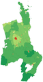 Waikato Region
 Bay of Plenty Region
 Gisborne Region
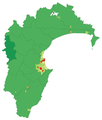 Hawke's Bay Region
 Taranaki Region
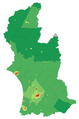 Manawatu-Wanganui Region
 Wellington Region
 Tasman and Nelson Regions
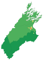 Marlborough Region
 Canterbury Region
 West Coast Region
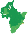 Otago Region
 Southland


