الأردن أو المملكة الأردنية الهاشمية هي دولة عربية مسلمة، تقع في شمال شبه الجزيرة العربية و في جنوب غرب آسيا. يحدها سوريا من الشمال، العراق من الشرق، السعودية من الجنوب والجنوب الشرقي، خليج العقبة من الجنوب الغربي، فلسطين وإسرائيل من الغرب. سميت بالأردن نسبة إلى نهر الأردن.
The Hashemite Kingdom of Jordan is an Arab country in the Middle East in western Asia. It is bordered by ► Syria to the north, ► Iraq to the north-east, ► Saudi Arabia to the east and south, and ► Israel and the ► West Bank to the west. It shares with Israel the coastlines of the Dead Sea, and the Gulf of Aqaba with Israel, Saudi Arabia, and ► Egypt.
This section holds a short summary of the history of the area of present-day Jordan, illustrated with maps, including historical maps of former countries and empires that included present-day Jordan.
The Region in the 9th to 7th centuries BC
Levant around 830 BCE.
Kingdom of Judah
Kingdom of Israel
Philistine city-states
Phoenician states
Kingdom of Ammon
Kingdom of Edom
Kingdom of Aram-Damascus
Aramean tribes
Arubu tribes
Nabatu tribes
Assyrian Empire
Kingdom of Moab
The region in the 9th century BCE with the Kingdoms of Ammon, Maob and Edom.
Roman Empire divided 395, showing the dioceses and praetorian prefectures of Gaul, Italy, Illyricum and Oriens (east), roughly analogous to the four Tetrarch zones of influence after Diocletian's reforms.
The division of the Empire after the death of Theodosius I, ca.395 AD superimposed on modern borders.
The WIKIMEDIA COMMONS Atlas of the World is an organized and commented collection of geographical, political and historical maps available at Wikimedia Commons. The main page is therefore the portal to maps and cartography on Wikimedia. That page contains links to entries by country, continent and by topic as well as general notes and references.
Every entry has an introduction section in English. If other languages are native and/or official in an entity, introductions in other languages are added in separate sections. The text of the introduction(s) is based on the content of the Wikipedia encyclopedia. For sources of the introduction see therefore the Wikipedia entries linked to. The same goes for the texts in the history sections.
Historical maps are included in the continent, country and dependency entries.
The status of various entities is disputed. See the content for the entities concerned.
The maps of former countries that are more or less continued by a present-day country or had a territory included in only one or two countries are included in the atlas of the present-day country. For example the Ottoman Empire can be found in the Atlas of Turkey.


 Ajlun Governorate nahias
 Amman Governorate nahias
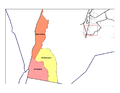 Aqaba Governorate nahias
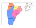 Balqa Governorate nahias
 Irbid Governorate nahias
 Jerash Governorate nahia
 Karak Governorate nahias
 Ma'an Governorate nahias
 Madaba Governorate nahias
 Mafraq Governorate nahias
 Tafilah Governorate nahias
 Zarqa Governorate nahias


.PNG)


