Ethiopia - Federal Democratic Republic of Ethiopia
The Federal Democratic Republic of Ethiopia is a country situated in the Horn of Africa (landlocked as of May 24, 1993). It is the third-most populous nation in Africa, bordered by ► Eritrea to the north, ► Djibouti to the northeast, ► Somalia, with ► Somaliland to the southeast, ► Kenya to the south, and ► Sudan to the west. Ethiopia is the only country in Africa with an unbroken sovereignty and is one of the oldest continuous nations in the world. Recently regarded as "the cradle of mankind", Ethiopia is also the second-oldest official Christian nation in the world, after Armenia. It has long been an intersection between the civilizations of North Africa, the Middle East and the rest of Africa. Unique among African countries, Ethiopia was never colonised, maintaining its sovereignty throughout the Scramble for Africa.
This section holds a short summary of the history of the area of present-day Ethiopia, illustrated with maps, including historical maps of former countries and empires that included present-day Ethiopia.
This section holds copies of original general maps more than 70 years old.
Upper Nubia and Abyssinia, 1891
Map of Egypt, Ethiopia and Sudan in 1892
Other maps
These maps are from before the independence of Eritrea
Economic map
Ethnic map
Vegetation map
Languages in Ethiopia
==Satellite maps==
Satellite map
Notes and references
General remarks:
The WIKIMEDIA COMMONS Atlas of the World is an organized and commented collection of geographical, political and historical maps available at Wikimedia Commons. The main page is therefore the portal to maps and cartography on Wikimedia. That page contains links to entries by country, continent and by topic as well as general notes and references.
Every entry has an introduction section in English. If other languages are native and/or official in an entity, introductions in other languages are added in separate sections. The text of the introduction(s) is based on the content of the Wikipedia encyclopedia. For sources of the introduction see therefore the Wikipedia entries linked to. The same goes for the texts in the history sections.
Historical maps are included in the continent, country and dependency entries.
The status of various entities is disputed. See the content for the entities concerned.
The maps of former countries that are more or less continued by a present-day country or had a territory included in only one or two countries are included in the atlas of the present-day country. For example the Ottoman Empire can be found in the Atlas of Turkey.
↑This entry contains Amhara characters. - (Can't see the fonts?. Romanization: ʾĪtyōṗṗyāye-Ītyōṗṗyā Fēdēralāwī Dīmōkrāsīyāwī Rīpeblīk.


 Addis Ababa
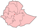
 Afar state
 Amhara state
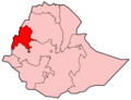 Benshangul-Gumaz state
 Dire Dawa
 Gambela state
 Harari state
 Oromia state
 Somali state
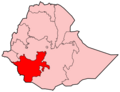 Southern Nations, Nationalities and Peoples state
 Tigray state


