The introductions of the country, dependency and region entries are in the native languages and in English. The other introductions are in English.
Atlas-country
Hungary
Magyarország
Magyar
Magyarország A Magyarország független állam Közép-Európában. Magyarország a Kárpát-medence közepén fekszik, területét a Duna osztja ketté. A Magyar Köztársaság fővárosa, politikai, gazdasági és kulturális központja Budapest, ahol az ország lakosságának mintegy 20%-a él.
English
Hungary - HungaryHungary ► Austria , ► Slovakia , ► Ukraine , ► Romania , ► Serbia (► Vojvodina ), ► Croatia , and ► Slovenia .
Short name
Hungary
Official name
Hungary
Status
Independent country since 1918, member of the ► European Union since 2004.
Location
East-Central Europe
Capital
Budapest
Population
9,769,000 inhabitants
Area
93,030 square kilometres (35,920 sq mi)
Major languages
Hungarian (official)
Major religions
Roman Catholicism, Protestantism
More information
Hungary , Geography of Hungary , History of Hungary and Politics of Hungary
More images
Hungary - Hungary (Category) .
General maps
English:
Magyar:
English:
Magyar:
English:
Magyar:
English:
Magyar:
English:
Magyar:
English:
Magyar:
English:
Magyar:
English:
Magyar:
English:
Magyar:
Magyar:
Regions of Hungary
History maps This section holds a short summary of the history of the area of present-day Hungary, illustrated with maps, including historical maps of former countries and empires that included present-day Hungary.
Historical maps of Hungary
Approximate extent of Pannonian Sea during the Miocene Epoch
Approximate extent of Pannonian Sea during the Miocene Epoch
approximate extent of Pannonian Sea during the Miocene Epoch
The celts BC800-BC400
Territorial development of the Roman Empire 264 BC-192, including the conquest of present
The extent of the Roman Republic and Roman Empire ;
44 BC (late Republic, after conquests by republican generals)
AD 14 (death of Augustus)
Camps of the Roman Legions in 80
Ancient peoples in Pannonia
Pannonia in the Roman Empire, 1st century
Pannonia in the Roman Empire, 1st century
Roman Pannonia, 1st century
Pannonia in the Roman Empire (116)
Pannonia provinces, 4th century
The division of the Empire after the death of Theodosius I , ca.395 AD superimposed on modern borders.
Invasions of the Roman Empire 100-500
Division of the Roman Empire in 406
Hun migration
Hun Empire
Hun Empire
[[|border|251x400px]]
Gepids and Langobards (6th century)
Kingdom of the Gepids in the 6th century (539-551)
Avar Khanate in 600
Avar Khanate in 650
[[|border|251x400px]]
Avar Khanate, 7th-8th century
[[|border|251x400px]]
Avars in the Carpathian basin, 680-804
Avar Khanate in 700
Avar Khanate in 814
Avar Khanate in the 9th century
[[|border|251x400px]]
Carpathian basin in the 9th century
[[|border|251x400px]]
Carpathian basin in the 9th century - Slovak and Hungarian views
Carpathian basin in the 9th century (according to the Gesta Hungarorum)
Location of Proto-Magyars (Proto-Hungarians) in 400 AD
Location of Magyars (Hungarians) in 500 AD
Location of Magyars (Hungarians) in 565 AD
Location of Magyars (Hungarians) in 700 AD
Hungarian Migration
Hungarian Migration
Hungarian Migration
Hungarian Migration
Hungarian campaigns
Hungary around 900
Kingdom of Hungary in the 10th century
Basic territory of Bijelo Brdo culture (10th-12th century)
Hungarians, Slavs and Vlachs in the Kingdom of Hungary, 10th-12th century (according to Serbian historian Jovan Pejin)
Hungary in 1000
Kingdom of Hungary in the 11th century
Kingdom of Hungary in 1190
The journeys of Friar Julian
[[|border|251x400px]]
Mongol invasion in 1241
[[|border|251x400px]]
Kingdom of Hungary in 1241
Kingdom of Hungary in the 13th century
Realms of Hungarian oligarchs in the 14th century
Kingdom of Hungary in 1360
Kingdom of Hungary in 1370-1387
Kingdom of Hungary in 1480
Kingdom of Hungary in 1490
Kingdom of Hungary in 1490
Border between Kingdom of Hungary and Ottoman Empire in the early 16th century
[[|border|251x400px]]
Kingdom of Hungary in 1514
Growth of the Ottoman Empire
Development of the European part of the Ottoman Empire
Growth of the Ottoman Empire
[[|border|251x400px]]
Kingdom of Hungary in the 16th century
Kingdom of Hungary in the 16th century
Kingdom of Hungary in 1526
Habsburg Monarchy in 1547
[[|border|251x400px]]
Kingdom of Hungary in 1550
Kingdom of Hungary in 1550
Captaincies of Royal Hungary and Budin Eyalet in 1572
Ottoman Empire in 1600
Ottoman Empire in 1683
Ottoman Empire in 1683
Ottoman Empire in 1683
Ottoman Empire in 1683
Kingdom of Hungary, Principality of Upper Hungary, Principality of Transylvania and Ottoman eyalets in 1683
[[|border|251x400px]]
Kingdom of Hungary, Principality of Upper Hungary, Principality of Transylvania and Ottoman eyalets in 1683
Great Serb migration in 1690
Kingdom of Hungary within Habsburg Monarchy in 1699
Kingdom of Hungary in the Habsburg Monarchy in 1763-1787
Kingdom of Hungary within Habsburg Monarchy in 1782-1785
Kingdom of Hungary within Habsburg Monarchy in 1782-1785
Kingdom of Hungary within Austrian Monarchy
Hungarian military districts in 1850
Kingdom of Hungary in 1862
Kingdom of Hungary in 1875
Ethnic groups in the Kingdom of Hungary in 1880
Hungarian language in 1880 (note: this map declares even areas with German minority as "German")
Ethnic map of Austria-Hungary, census 1880. German version
Religions in Austria-Hungary, Andrees Allgemeiner Handatlas, 1st Edition, Leipzig (Germany) 1881
Etnographic map (1885-1890)
Hungarians in the Kingdom of Hungary in 1890
Hungarians in the Kingdom of Hungary in 1890
Ethnic map of Austria-Hungary, census 1890. English version
Etnographic map (1900)
Historical map of Austria-Hungary from the Bibliothek allgemeinen und praktischen Wissens für Militäranwärter Band I, 1905
Etnographic map (1910)
Etnographic map (1910), made by Pál Teleki
Etnographic map (1911)
Hungarians in Austria-Hungary in 1911
Szekelys in the Kingdom of Hungary
Location of the Kingdom of Hungary
Kingdoms and countries of Austria–Hungary: Cisleithania Bohemia , 2. Bukovina , 3. Carinthia , 4. Carniola , 5. Dalmatia , 6. Galicia , 7. Austrian Littoral , 8. Lower Austria , 9. Moravia , 10. Salzburg , 11. Silesia , 12. Styria , 13. Tyrol , 14. Upper Austria , 15. Vorarlberg ; Transleithania Hungary , 17. Croatia and Slavonia ; 18. Bosnia and Herzegovina
Austria-Hungary in 1914
South Front in World War I
East Front open in World War I
Cantonized Hungary, proposed by Miksa Strobl in 1918
Hungarian Soviet Republic
Treaty of Trianon
Treaty of Trianon
Treaty of Trianon
Treaty of Trianon - Ethnic map
Treaty of Trianon - Ethnic map
[[|border|251x400px]]
Treaty of Trianon - Ethnic map
Hungary between World Wars
Hungary in 1923
Hungary in 1938
Hungary in 1939
Hungary in 1940
Hungary in 1941-1944
1942 Raid in southern Bačka
The Allied offensive on Southern Central Europe
Hungary from 1867 to 1947
Hungary in 1950
Historical maps of Hungarians in Transylvania
Transylvania in the 13th century
Székely Land in medieval Transylvania
Transylvania in the 16th century
Székely Seats
Transylvania in 1570
Northern Transylvania annexed to Hungary in World War II
Hungarian Autonomous Province, 1952-1960
Hungarian Autonomous Province, 1952-1968
Emigration of the Székelys
Historical maps of Hungarians in Slovakia
Hungarians in Slovakia in 1910
Hungarian language in Czechoslovakia in 1930
Hungarian annexation of southern Slovakia in 1938
Hungarian annexation of southern Slovakia in 1938
Historical maps of Hungarians in Vojvodina
Domain of medieval Hungarian oligarch Ugrin Csak
Serb-Hungarian frontlines in the territory of present-day Vojvodina in 1848-1849
Hungarian counties in the territory of present-day Vojvodina in 1881-1882
Ethnic Hungarians in the territory of present-day Vojvodina in 1910
Hungarian language in the territory of present-day Vojvodina in 1910
Hungarian language in Vojvodina in 1921
Hungarian language in Vojvodina in 1931
Old maps This section holds copies of original general maps more than 70 years old.
Hungary and Turkey in Europe
Linguistic, ethnic and religion maps
Hungarians outside of Hungary
Alternative map
Roma (Gypsies) in Hungary (census 2001, by localities)
Roma (Gypsies) in Hungary (census 2001, by counties)
Roma (Gypsies) in Hungary (census 2001, by counties)
Religion map of Hungary
Religion map of Hungary
Regions and counties of Hungary
Counties
városok, községek, and megyei jogú városok
Jászság (Jazygia) region in Hungary
Baranya / Baranja region, divided between Hungary and Croatia
Bačka / Bácska region, divided between Serbia and Hungary
Banat region, divided between Romania, Serbia and Hungary
Satellite maps
Satellite map
Satellite map
Notes and references
General remarks:
The WIKIMEDIA COMMONS Atlas of the World is an organized and commented collection of geographical, political and historical maps available at Wikimedia Commons. The main page is therefore the portal to maps and cartography on Wikimedia. That page contains links to entries by country, continent and by topic as well as general notes and references .
Every entry has an introduction section in English. If other languages are native and/or official in an entity, introductions in other languages are added in separate sections. The text of the introduction(s) is based on the content of the Wikipedia encyclopedia. For sources of the introduction see therefore the Wikipedia entries linked to. The same goes for the texts in the history sections.
Historical maps are included in the continent, country and dependency entries.
The status of various entities is disputed. See the content for the entities concerned.
The maps of former countries that are more or less continued by a present-day country or had a territory included in only one or two countries are included in the atlas of the present-day country. For example the Ottoman Empire can be found in the Atlas of Turkey .
Entries available in the atlas 


.PNG)


.jpg)


_in_Hungary,_census_1890.jpg)
.png)
.JPG)


.png)


_in_Hungary_(census_2001).png)

.png)


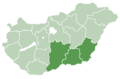 Dél-Alföld region
 Dél-Dunántúl region
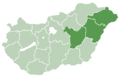 Észak-Alföld region
 Észak-Magyarország region
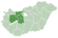 Közép-Dunántúl region
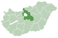 Közép-Magyarország region
 Nyugat-Dunántúl region


 Magyar: Budapest
 English: Baranya countyMagyar: Baranya megye
 English: Bács-Kiskun countyMagyar: Bács-Kiskun megye
 English: Békés countyMagyar: Békés megye
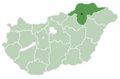 English: Borsod-Abaúj-Zemplén countyMagyar: Borsod-Abaúj-Zemplén megye
 English: Csongrád countyMagyar: Csongrád megye
 English: Fejér countyMagyar: Fejér megye
 English: Győr-Moson-Sopron countyMagyar: Győr-Moson-Sopron megye
 English: Hajdú-Bihar countyMagyar: Hajdú-Bihar megye
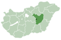 Jász-Nagykun-Szolnok county
 Komárom-Esztergom county
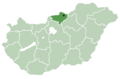 Nógrád county
 Somogy county
 Szabolcs-Szatmár-Bereg county
 Tolna county
 Vas county
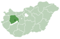 Veszprém county
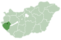 Zala county


