Rzeczpospolita Polska – państwo położone w Europie Środkowej nad Morzem Bałtyckim. Graniczy z Niemcami (na zachodzie), Czechami, Słowacją (na południu), Ukrainą, Białorusią, Litwą (na wschodzie) i Rosją (obwodem kaliningradzkim, na północy), a poprzez granicę morską (granicę wyłącznej strefy ekonomicznej) również z Danią oraz Szwecją.
Other languages
Deutsch: Polen ist ein Staat in Mitteleuropa. Das Land grenzt im Norden an die russische Exklave Kaliningrad (210 km) und an Litauen (103 km), im Osten an Belarus (416 km) und die Ukraine (529 km), im Süden an die Slowakei (539 km) und Tschechien (790 km) sowie im Westen an Deutschland (467 km). Des Weiteren hat das Land eine 528 km lange Ostseeküste. Insgesamt sind Polens Grenzen 3.582 km lang. Die längste Nord-Süd-Ausdehnung beträgt 790 km, die längste Ost-West-Ausdehnung 680 km
The Republic of Poland is a country in Central Europe or Eastern Europe, depending on the definition, bordered by ► Germany to the west, the ► Czech Republic and ► Slovakia to the south, ► Ukraine and ► Belarus to the east, and the Baltic Sea, ► Russia (in the form of the Kaliningrad Oblast exclave) and ► Lithuania to the north. It also shares a maritime border with Denmark and Sweden. The total area of Poland is 312,683 sq km (120,728 sq mi) making it the 69th largest country in the world with population over 38.5 million people concentrated mainly in large cities, including the most populated urban area of Poland, Silesian conurbation (albeit administratively divided into separate cities and towns), the present capital of Poland, Warsaw, the historical capital, Kraków, and industrial city of Łódź.
Short name
Poland
Official name
Republic of Poland
Status
Independent country since the ninth century, interrupted between 1795 and 1918 as well as between 1939 and 1945, member of the ► European Union since 2004
This section holds a short summary of the history of the area of present-day Poland, illustrated with maps, including historical maps of former countries and empires that included present-day Poland.
Template:Left-par
Possible extent of (proto-)Celtic influence 800-400 BC
Celts in Europe
Pre-Roman iron age (Proto-Germanic) peoples
Map showing the pre-Migration Age distribution of the Germanic tribes in Proto-Germanic times, and stages of their expansion up to 50 BC, AD 100 and AD 300.
The origin and dispersion of Slavs in the 5th-10th centuries
Slavic tribes in 7th-9th century Europe
West Slavs in the 9th-10th centureis
Map of Slavic peoples in the 8/9c.
Independent Poland
Polan strongholds during the early reign of Mieszko I
Map of Poland 960-992
Map of Poland 992-1025
Map of Poland 1039-1058
Poland 1201-1241
Poland 1275-1300
Poland 1304-1333
Poland 1333-1370
Poland and Hungary in 1360
Hanseatic trade routes
Poland and Lithuania during reign of Władysław II Jagiełło 1386-1434 since Ilustrowany atlas historii Polski, wyd. Demart, Warszawa 2006
English version of Poland and Lithuania during reign of Władysław II Jagiełło 1386-1434 since Hans-Erich Stier (dir.) Grosser Atlas zur Weltgeschichte, Westermann 1985, ISBN3-14-100919-8
In 1386 Poland and Lithuania formed a Polish-Lithuanian personal union. Large parts of present-day Belarus and Ukraine were part of Poland-Lithuania. This map shows the borders in 1466
1569-1795: Commonwealth of Two Nations {Rzeczpospolita Obojga Narodów, Abiejų Tautų Respublika} - Independent country, better known as Polish-Lithuanian Commonwealth
In 1569 the personal union is succeeded by the Polish-Lithuanian Commonwealth, a state that existed until the 3rd partition of 1795.
Polish-Lithuanian Commonwealth 1569
Location of the Polish Lithuanian Commonwealth
Polish Lithuanian Commonwealth compared with present borders
Religions in Poland 1573
Polish Lithuanian Commonwealth
Polish-Swedish Union 1592-1599
Commonwealth 1600
Commonwealth in 1619
Commonwealth 1635
Commonwealth 1648
Commonwealth 1658
Commonwealth 1660
Commonwealth 1686
Commonwealth, division in voivodships
Commonwealth 1701
Religions in Poland 1750
Physical map of Poland-Lithuania 1764
7 years war 1756-1762
Bar Confederation 1768-1772
Polish-Lithuanian Commonwealth as a protectorate of Russian Empire in 1772
The partitions of the Commonwealth
Commonwealth after 1st partition
Polish-Russian War 1792
Commonwealth after 2nd partition
Poland 1794
Divided Poland
The third partition meant the end of the Polish-Lithuanian Commonwealth and the final division between Prussia, Russia and Austria after 3rd partition
Border changes between Poland and Prussia 1600-1795
Duchy of Warsaw and Republic of Gdańsk, during the Napoleon era
Duchy of Warsaw
Duchy of Warsaw 1810/Ks. Warszawskie 1810
Wolne Miasto Kraków, 1815-1846
Free City of Cracow, 1815-1846
Physical map of Galicia 1846-1918
Galicia, administrative 1914
Kingdom of Poland 1815-1831
Wolne Miasto Gdańsk 1807-1815/Free City Gdańsk/Danzig 1807-1815
Congress Poland, Grand Duchy of Posen and Free City of Kraków in 1815
Poland 1815-30 (Congress Poland), inside the Russian Empire
Ethnic map of European Russia before the First World War (in French)
Congress Poland, administrative division as of 1907
In 1923 the city of Gdańsk became a Free City under protection of the Leage of Nations. Gdańsk was annexed by Germany in 1939 and is now part of Poland.
Old maps
This section holds copies of original general maps more than 70 years old.
English map of Poland - XVIII century
Poland in 1836
Poland in 1902
Other maps
Airports
Polish airports in 2011 - passenger traffic
Polish airports in 2007 - passenger traffic
Polish airports in 2006 - passenger traffic
Polish airports in 2005 - passenger traffic
Catholic Dioceses
Satellite maps
Satellite map
Satellite map
Satellite map
Notes and references
General remarks:
The WIKIMEDIA COMMONS Atlas of the World is an organized and commented collection of geographical, political and historical maps available at Wikimedia Commons. The main page is therefore the portal to maps and cartography on Wikimedia. That page contains links to entries by country, continent and by topic as well as general notes and references.
Every entry has an introduction section in English. If other languages are native and/or official in an entity, introductions in other languages are added in separate sections. The text of the introduction(s) is based on the content of the Wikipedia encyclopedia. For sources of the introduction see therefore the Wikipedia entries linked to. The same goes for the texts in the history sections.
Historical maps are included in the continent, country and dependency entries.
The status of various entities is disputed. See the content for the entities concerned.
The maps of former countries that are more or less continued by a present-day country or had a territory included in only one or two countries are included in the atlas of the present-day country. For example the Ottoman Empire can be found in the Atlas of Turkey.


.png)
 Zachodniopomorskie
 Wielkopolskie
 Pomorskie
 Podlaskie
 Podkarpackie
 Opolskie
 Mazowieckie
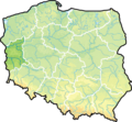 Lubuskie
 Lubelskie
 Kujawsko-pomorskie
 Dolnoślaskie
.png)
.png)
.png)
.png)
.png)
.png)
.png)
.png)
.png)
.png)
.png)


.PNG)


.png)
.png)
.png)


_and_the_Crown_of_the_Kingdom_of_Poland_(red)_in_1386_-_1434.png)
_and_the_Crown_of_the_Kingdom_of_Poland_(red)_and_its_neighborhood_in_1386_%E2%80%93_1434_(English_version).png)


.png)

_rus.png)


.svg)

.svg)


