The Slovak Republic is a landlocked country in Central Europe with a population of over five million. It is a member of the European Union (since May 1, 2004) and borders the ► Czech Republic and ► Austria in the west, ► Poland in the north, ► Ukraine in the east and ► Hungary in the south. The largest city is its capital, Bratislava. See also: Atlas of the European Union.
Short name
Slovakia
Official name
Slovak Republic
Status
Independent country since 1993, member of the ► European Union since 2004
This section holds a short summary of the history of the area of present-day Slovakia, illustrated with maps, including historical maps of former countries and empires that included present-day Slovakia.
Neolithic cultures, 5th milennium BC
Neolithic cultures, 4500-4000 BC
Neolithic cultures, 4000-3500 BC
Neolithic cultures, late 4th millennium BC
Indo-European expansion
Possible extent of (proto-)Celtic influence, 800-400 BC
Die Kelten in Europa. Ocker: Kernbereich Nordwestalpine Hallstattkultur (ca. 750–500/450 v. Chr.) grün: Ausbreitung La-Tène-Kultur, bzw. orange: der keltischen Sprache (3. Jh. v. Chr.)
Old map of Austria-Hungary from the Bibliothek allgemeinen und praktischen Wissens für Militäranwärter Band I, 1905
Religions in Austria-Hungary
Distribution of Races in Austria-Hungary
Satellite maps
Satellite map
Notes and references
General remarks:
The WIKIMEDIA COMMONS Atlas of the World is an organized and commented collection of geographical, political and historical maps available at Wikimedia Commons. The main page is therefore the portal to maps and cartography on Wikimedia. That page contains links to entries by country, continent and by topic as well as general notes and references.
Every entry has an introduction section in English. If other languages are native and/or official in an entity, introductions in other languages are added in separate sections. The text of the introduction(s) is based on the content of the Wikipedia encyclopedia. For sources of the introduction see therefore the Wikipedia entries linked to. The same goes for the texts in the history sections.
Historical maps are included in the continent, country and dependency entries.
The status of various entities is disputed. See the content for the entities concerned.
The maps of former countries that are more or less continued by a present-day country or had a territory included in only one or two countries are included in the atlas of the present-day country. For example the Ottoman Empire can be found in the Atlas of Turkey.


.png)


.jpg)


.JPG)


.png)


 Bratislavský kraj
 Trenčiansky kraj
 Trnavský kraj
 Nitriansky kraj
 Žilinský kraj
 Banskobystrický kraj
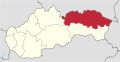 Prešovský kraj
 Košický kraj


