A República Federativa do Brasil é o terceiro maior em área e o segundo mais populoso país das Américas e o quinto maior em área e população do mundo. Sua área total é de 8.514.876,599 km² e localiza-se na parte centro-oriental da América do Sul. Suas fronteiras ao norte são com a Venezuela, a Guiana, o Suriname e com o departamento ultramarino francês da Guiana Francesa; a leste e sudeste faz fronteira com o Oceano Atlântico. Ao sul, limita com o Uruguai; a sudoeste, com a Argentina e o Paraguai; a oeste, com a Bolívia e o Peru, e a noroeste, com a Colômbia. Os únicos países sul-americanos que não fazem fronteira com o Brasil são o Chile e o Equador.
The Federative Republic of Brazil is the largest and most populous country in South America; and the fifth largest in the world in both area and population. Spanning a vast area between central South America and the Atlantic Ocean, it is the easternmost country of America and borders every other South American country other than Ecuador and Chile (viz. ► Uruguay, ► Argentina, ► Paraguay, ► Bolivia, ► Peru, ► Colombia, ► Venezuela, ► Guyana, ► Suriname and the French department of ► French Guiana). To the east in the Atlantic Ocean lie ► Saint Helena and ► Ascension Island.
This section holds maps of the administrative divisions.
Regiões / regions
Centro-Oeste (Center-West)
Nordeste (Northeast)
Norte (North)
Sudeste (Southeast)
Sul (South)
Centro-Oeste
Nordeste
Norte
Sudeste
Sul
Estados / states
Acre
Alagoas
Amapá
Amazonas
Bahia
Ceará
Distrito Federal
Espírito Santo
Goiás
Maranhão
Mato Grosso
Mato Grosso do Sul
Minas Gerais
Pará
Paraíba
Paraná
Pernambuco
Piauí
Rio de Janeiro
Rio Grande do Norte
Rio Grande do Sul
Rondônia
Roraima
Santa Catarina
São Paulo
Sergipe
Tocantins
Acre
Alagoas
Amapá
Amazonas
Bahia
Ceará
Distrito Federal
Espírito Santo
Goiás
Maranhão
Mato Grosso
Mato Grosso do Sul
Minas Gerais
Pará
Paraíba
Paraná
Pernambuco
Piauí
Rio de Janeiro
Rio Grande do Norte
Rio Grande do Sul
Rondônia
Roraima
Santa Catarina
São Paulo
Sergipe
Tocantins
Cidades / cities
English: Map of ports
Localização de Belém no Brasil
Localização de Florianópolis no Brasil
Localização de Fortaleza no Brasil
Localização de Goiânia no Brasil
Localização de Salvador no Brasil
Localização de São Luís no Brasil
Map of Brazil
History maps
This section holds a short summary of the history of the area of present-day Brazil, illustrated with maps, including historical maps of former countries and empires that included present-day Brazil.
Captaincies of Colonial Brazil 1534
Portuguese colonial possessions in the 19th century
This section holds copies of original general maps more than 70 years old.
Map of Brazil, 1519
Hydrographic maps
English: Map of rivers
English: Map of river basins
English: Eastern rivers
Rio São Francisco
Rio Tietê / Rio Paraná
English: Amazon river basin
Português: O mapa mostra a Região Hidrográfica do Amazonas
Other maps
Population, Administrative Divisions and Economic Regions Map (1977)
Population density (2000)
Population density (2020)
Population distribution in Brazil (2000).
Vegetation map
Vegetation map
Temperature and precipitation
Climate classification for Brazil, according to the Köppen criteria.
Economic Activity (1977)
Land use
Agriculture in Brazil
Ports of Brazil
Uranium in Brazil
English: Map of rivers
English: Map of river basins
English: Eastern rivers
River São Francisco
Rio Tietê / Rio Paraná
English: Amazon river basin
English: Hydrographic map of Amazonas
English: Map of Brazilian states by area
English: Map of Brazilian states by GDP per capita
English: Map of Brazilian States by GDP
English: Map of Brazilian States by HDI
English: Map of Brazilian States by Infant mortality
English: Map of Brazilian states by Life expectancy
English: Map of Brazilian states by Literacy rate
English: Map of Brazilian states by Population density
English: Map of Brazilian states by Population
English: Map of Brazilian states by Race
Português: Mapa-mundi
English: Worldmap
Brasil
Português: Contorno fino do mapa do Brasil.
English: Numbered map
English: Map of Brasil in French.
Français : Carte du Brésil en Francais.
Português: Mapa do Brasil com a bandeira nacional.
English: Map of Brasil with flag.
Português: Topografia do Brasil.
English: Topographical map of Brasil.
Notes and references
General remarks:
The WIKIMEDIA COMMONS Atlas of the World is an organized and commented collection of geographical, political and historical maps available at Wikimedia Commons. The main page is therefore the portal to maps and cartography on Wikimedia. That page contains links to entries by country, continent and by topic as well as general notes and references.
Every entry has an introduction section in English. If other languages are native and/or official in an entity, introductions in other languages are added in separate sections. The text of the introduction(s) is based on the content of the Wikipedia encyclopedia. For sources of the introduction see therefore the Wikipedia entries linked to. The same goes for the texts in the history sections.
Historical maps are included in the continent, country and dependency entries.
The status of various entities is disputed. See the content for the entities concerned.
The maps of former countries that are more or less continued by a present-day country or had a territory included in only one or two countries are included in the atlas of the present-day country. For example the Ottoman Empire can be found in the Atlas of Turkey.

_-_BRA_-_UNOCHA.svg)


 Centro-Oeste (Center-West)
 Nordeste (Northeast)
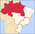 Norte (North)
 Sudeste (Southeast)
 Sul (South)
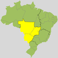 Centro-Oeste
 Nordeste
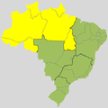 Norte
Norte Sudeste
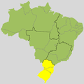 Sul
Sul


 Acre
Acre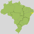 Alagoas
 Amapá
Amapá Amazonas
 Bahia
Bahia Ceará
Ceará Distrito Federal
 Espírito Santo
 Goiás
Goiás Maranhão
 Mato Grosso
 Mato Grosso do Sul
 Minas Gerais
 Pará
Pará Paraíba
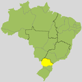 Paraná
 Pernambuco
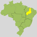 Piauí
Piauí Rio de Janeiro
 Rio Grande do Norte
 Rio Grande do Sul
 Rondônia
 Roraima
 Santa Catarina
 São Paulo
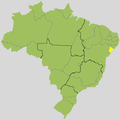 Sergipe
 Tocantins


 Acre
Acre Alagoas
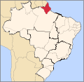 Amapá
Amapá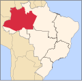 Amazonas
 Bahia
Bahia Ceará
Ceará Distrito Federal
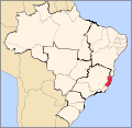 Espírito Santo
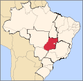 Goiás
Goiás Maranhão
 Mato Grosso
 Mato Grosso do Sul
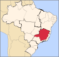 Minas Gerais
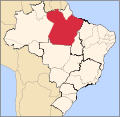 Pará
Pará Paraíba
 Paraná
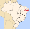 Pernambuco
 Piauí
Piauí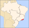 Rio de Janeiro
 Rio Grande do Norte
 Rio Grande do Sul
 Rondônia
 Roraima
 Santa Catarina
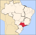 São Paulo
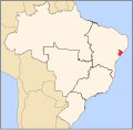 Sergipe
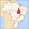 Tocantins


 English: Map of ports
 Localização de Belém no Brasil
 Localização de Florianópolis no Brasil
 Localização de Fortaleza no Brasil
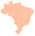 Localização de Goiânia no Brasil
 Localização de Salvador no Brasil
 Localização de São Luís no Brasil


_-_en_-_colored.svg)

 English: Map of rivers
 English: Map of river basins
 English: Eastern rivers
 Rio São Francisco
 Rio Tietê / Rio Paraná
 English: Amazon river basin
 Português: O mapa mostra a Região Hidrográfica do Amazonas


 Português: Mapa-mundiEnglish: Worldmap
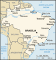 Brasil
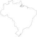 Português: Contorno fino do mapa do Brasil.
 English: Numbered map


 English: Map of Brasil in French.Français : Carte du Brésil en Francais.
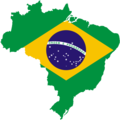 Português: Mapa do Brasil com a bandeira nacional.English: Map of Brasil with flag.
 Português: Topografia do Brasil.English: Topographical map of Brasil.


.png)


