A República Democrática de São Tomé e Príncipe é um estado insular localizado no Golfo da Guiné, composto por duas ilhas principais (São Tomé e Príncipe) e várias ilhotas, num total de 964 km², com cerca de 120 mil habitantes. Estado insular, não tem fronteiras terrestres, mas situa-se relativamente próximo das costas do Gabão, Guiné Equatorial, Camarões e Nigéria.
The Democratic Republic of Sao Tome and Principe is an island nation in the Gulf of Guinea, off the western equatorial coast of Africa. It consists of two islands: São Tomé and Príncipe, located about 140 kilometres apart and about 250 and 225 kilometres respectively, off of the northwestern coast of ► Gabon. Both islands are part of an extinct volcanic mountain range. São Tomé, the sizable southern island, is situated almost exactly on the equator. It is named after Saint Thomas by Portuguese explorers who discovered the island on his feast day. Sao Tome and Principe is the second smallest (in terms of population) African country (larger only than Seychelles). A neighboring island nation is ► Equatorial Guinea.
This section holds maps of the administrative divisions.
Districts
Água Grande District
Cantagalo District
Caué District
Lembá District
Lonatá District
Mé-Zóchi District
Pagué District
Satellite maps
Satellite map
Notes and references
General remarks:
The WIKIMEDIA COMMONS Atlas of the World is an organized and commented collection of geographical, political and historical maps available at Wikimedia Commons. The main page is therefore the portal to maps and cartography on Wikimedia. That page contains links to entries by country, continent and by topic as well as general notes and references.
Every entry has an introduction section in English. If other languages are native and/or official in an entity, introductions in other languages are added in separate sections. The text of the introduction(s) is based on the content of the Wikipedia encyclopedia. For sources of the introduction see therefore the Wikipedia entries linked to. The same goes for the texts in the history sections.
Historical maps are included in the continent, country and dependency entries.
The status of various entities is disputed. See the content for the entities concerned.
The maps of former countries that are more or less continued by a present-day country or had a territory included in only one or two countries are included in the atlas of the present-day country. For example the Ottoman Empire can be found in the Atlas of Turkey.


.jpg)

 Água Grande District
 Cantagalo District
 Caué District
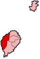 Lembá District
 Lonatá District
 Mé-Zóchi District
 Pagué District


